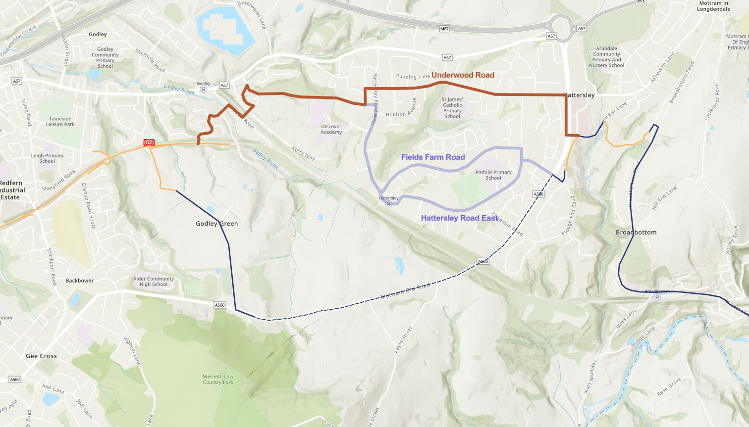
Sustrans and Tameside Council have presented plans for the Trans Pennine Trail to follow a brand new route between Godley and Hattersley, finally cutting out the completely unsuitable A560 Mottram Old Road.
Hearing the words “Trans Pennine Trail missing link” might lead to the question “which one?”, especially around this area of Greater Manchester and Derbyshire. There’s the not-particularly-great road through Broadbottom, the disconnected Gamesley Sidings, the soul-destroying A626 slog through Charlesworth, the confusing path-that-isn’t at Wooley Bridge…
But at last, just before Christmas, surprise proposals were opened for public feedback to create a brand new link between Godley and Hattersley on NCN 62.

The new route would leave the Godley Link Line between houses to the north, shimmy through an existing tunnel under the Glossop railway line, then run around the large Kerry Foods factory via an upgraded bridleway.
Emerging in Hattersley, there’d be largely brand new segregated cycleways to link to the monstrous A560 then back down to where a path links across to Broadbottom.


- View the proposals and comment here — closes 15th January 2022
While solving at least one of the TPT’s poorest sections in this area, it’d also give Hattersley — which has seen major development in recent years — a usable cycle link in towards Hyde and the rest of Greater Manchester.
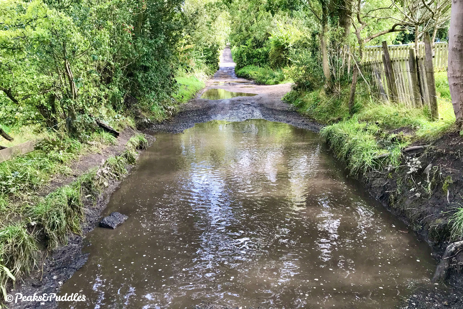
Even ignoring the nightmare climb up the increasingly busy A560, the current route uses the comically potholed Green Lane, often more suitable in places for kayaks than bikes.

There has previously been suggestion that the TPT will be re-routed via the highly controversial Godley Green Garden Village development to the south, which is being planned to link to Hattersley with a cycle/pedestrian bridge. But even if this does go ahead, it’s still years away from even breaking ground.
The proposals look mostly good, if not outstanding as a complete or direct route. In true TPT style, there are some odd dog-legs and compromises in routing, several sections that look too secluded from passive surveillance, but also some very welcome properly segregated road sections and parallel crossings.
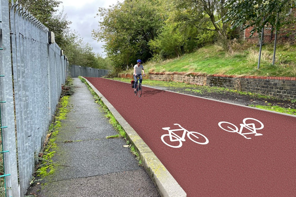
The bridleway would be Flexipave (or similar) and mostly 3 metres where possible, 2.5 metres in some places.


One barrier at the exit from the existing Godley Link Line railway path is proposed to be changed to a sort of flat chicane, which would continue to narrow the path unnecessarily. As usual, a single bollard would be simpler and better. There’s no mention of removing the god-awful a-frames elsewhere on that path (which is apparently owned by Sustrans themselves).
The plans are open for feedback only until 15th January — so take a look and get in now with any comments. (Note to planners: the week before Christmas is not the best time to launch something like this.)
