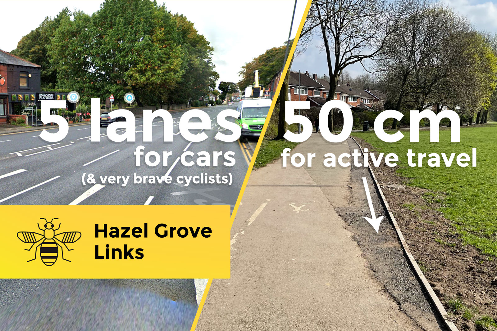
Stockport Council has begun work on its most south-easterly Bee Network walking and cycling project. Originally announced towards the end of 2018, the “Hazel Grove Links” scheme seeks to modestly improve existing links with path widening, a crossing and filter points.
Known originally as “Hazel Grove Access Upgrade”, this package of minor tweaks to some just-about-usable local links, avoiding the A6, looked like a good set of quick wins. That was back in late 2018, when it was announced with a projected cost of £0.9m.
While doing nothing at all to transform the traffic-blighted centre of Hazel Grove nor the inefficient four-lane A6 carriageway which cuts through it, it would at least provide blibs and blobs of appreciated fixes to parallel cycle routes which, despite being nowhere near ideal, are fairly well-used.
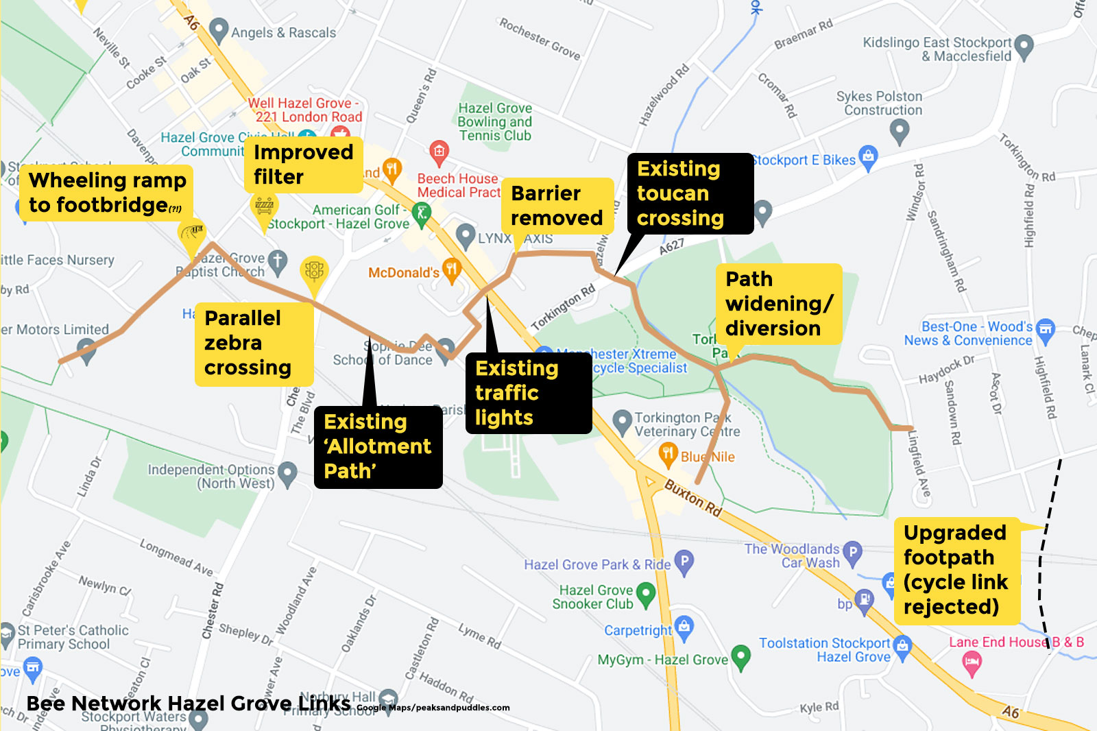
Now coming to life some three and bit years — and a global pandemic, and ever closer to climate catastrophe — later, and with no movement on a projected “busy beeway” route along the A6 to Stockport, it gives a very different feeling: embarrassingly inadequate. No longer the quick wins I, at least, naively thought.
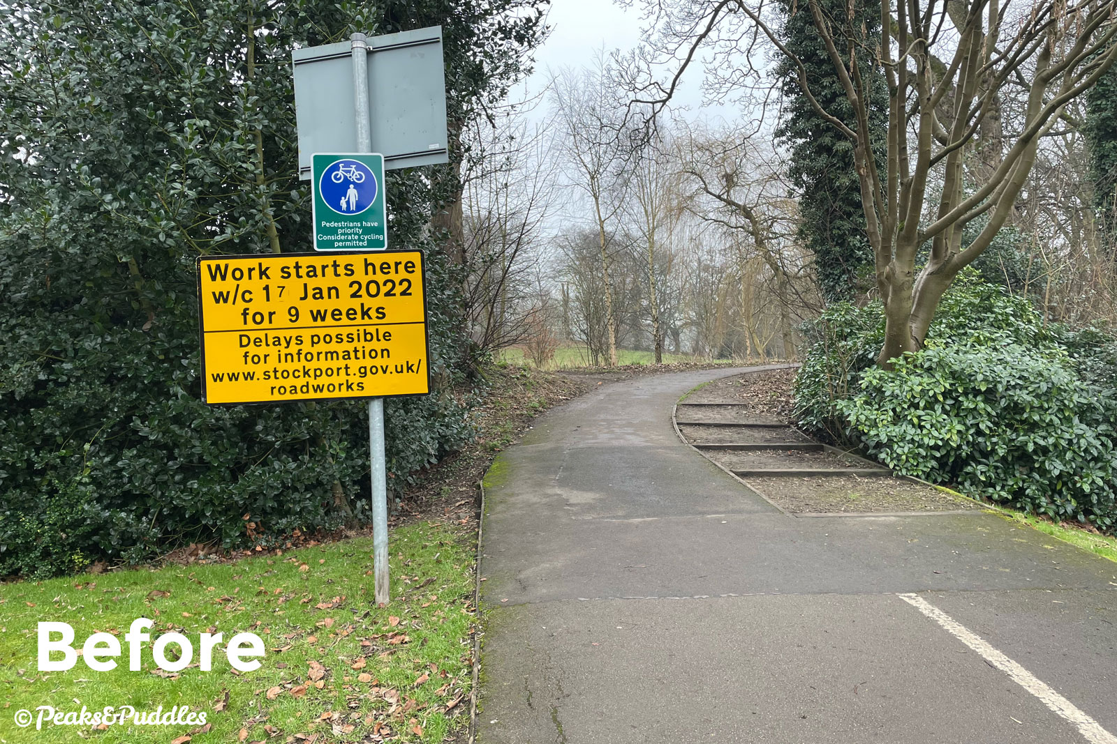
And yes, while work has begun on these incredibly minor upgrades, the only work programmed and completed thus far is an “upgrade” of the shared route through Torkington Park.
Behold, Hazel Grove’s active travel Bee Network…
Torkington Park
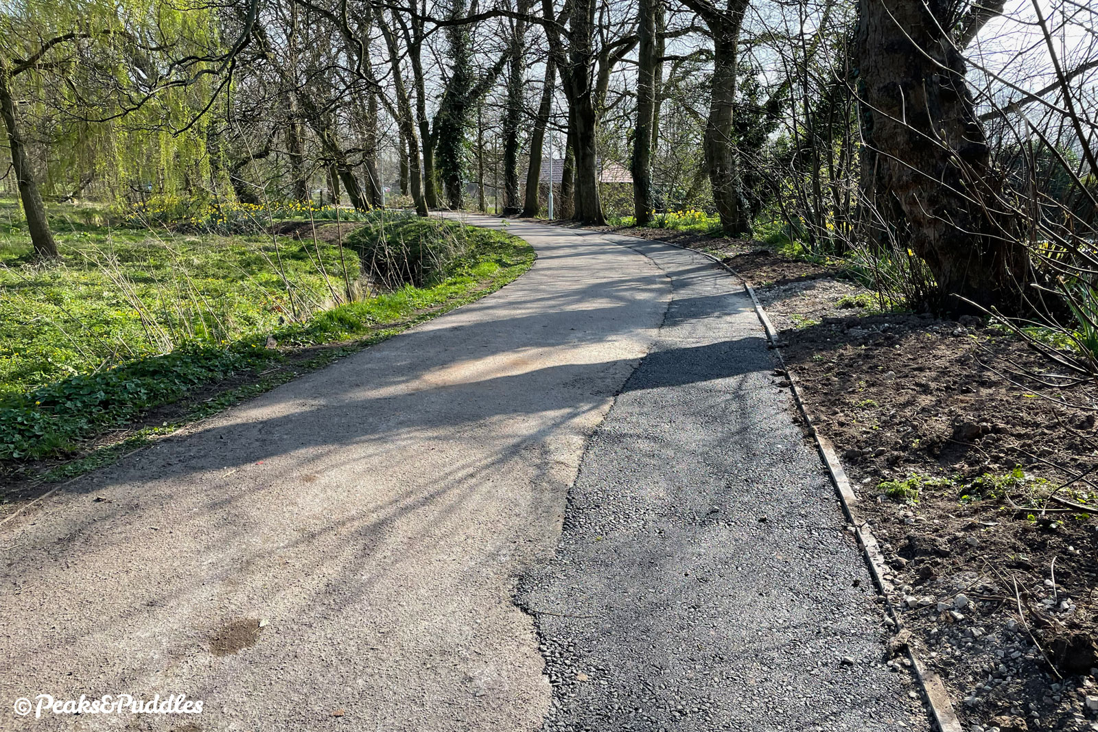
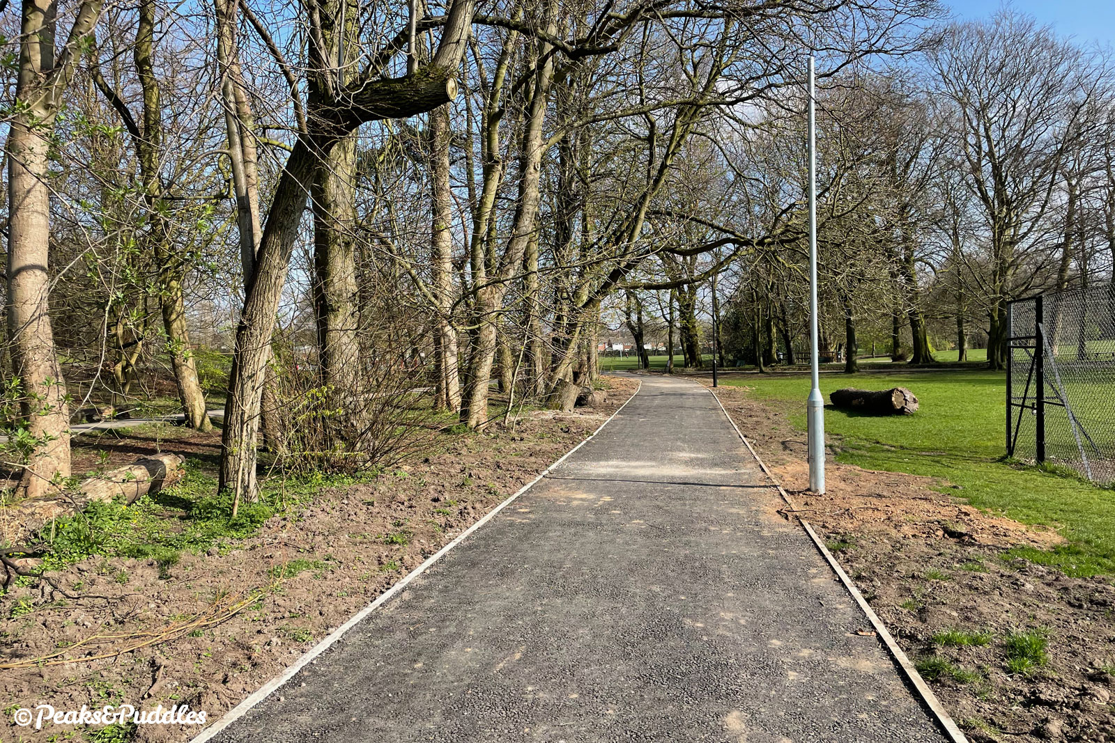
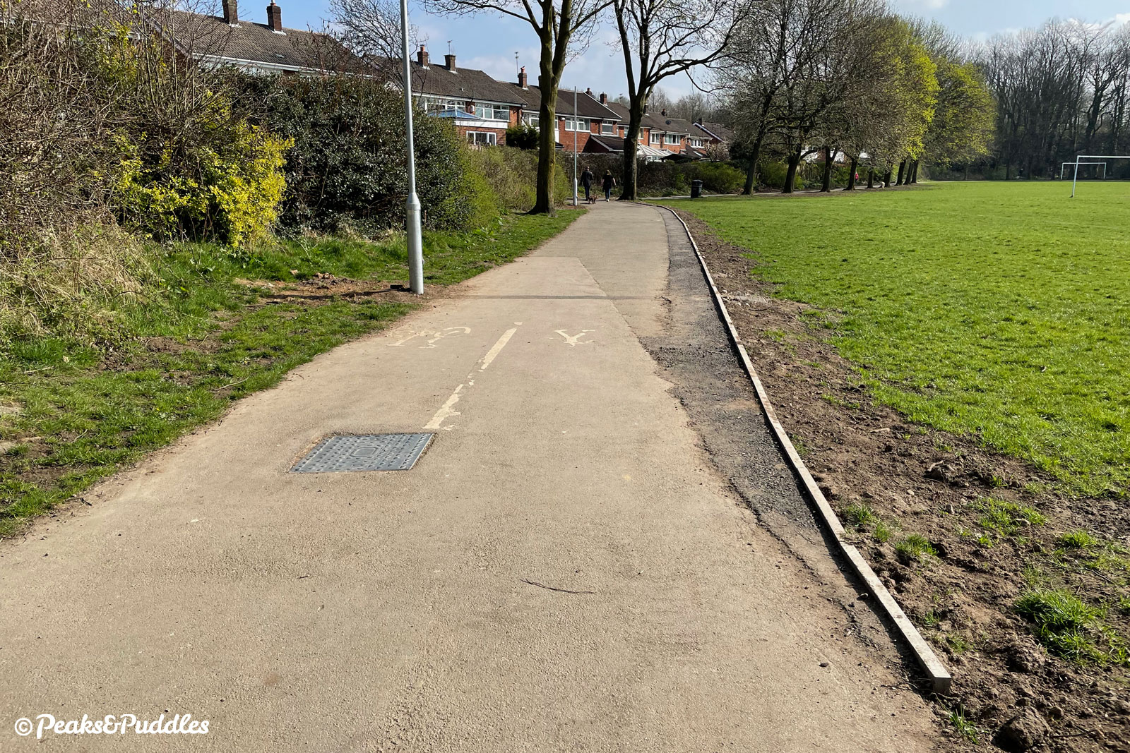
Starting from an existing toucan crossing of Torkington Road and heading south, the work has added between 50 cm and 1 metre to the existing path to make it a standard 3 metres.
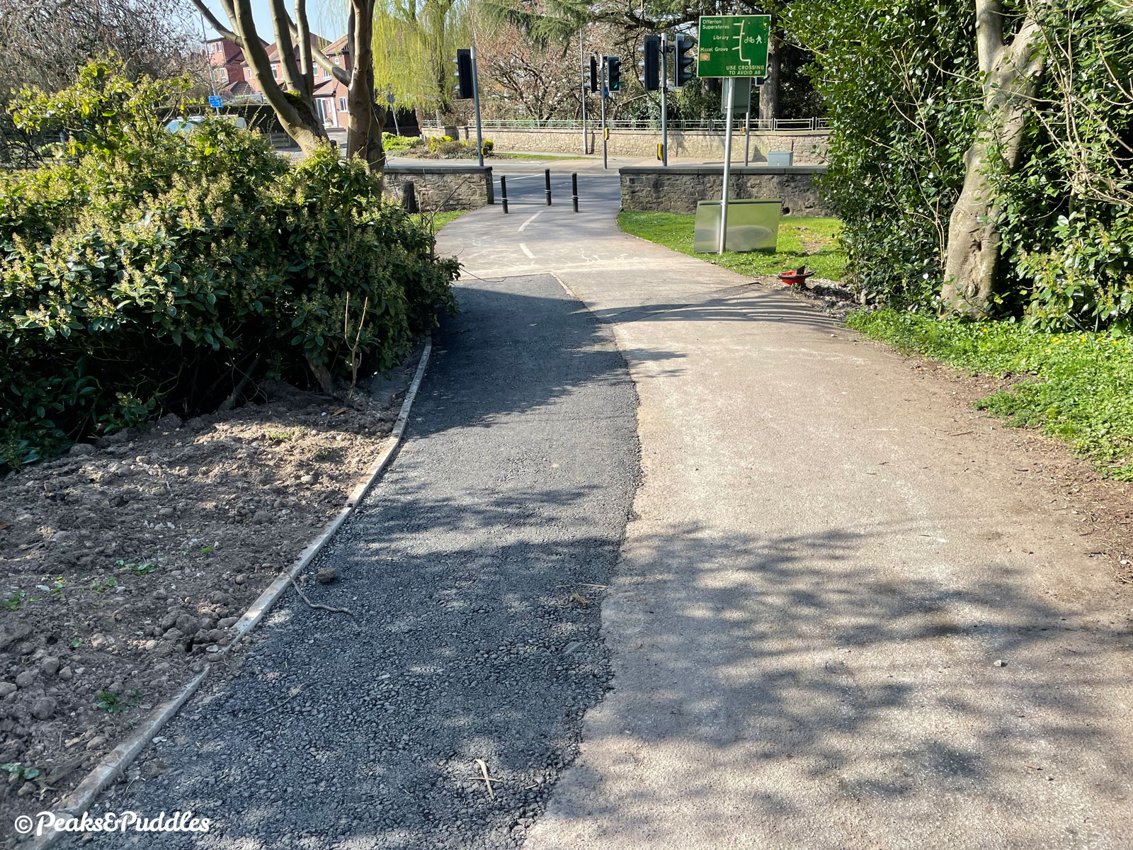
In fact, this path used to be wider anyway, with a separate dirt footpath that became lost in vegetation, now surfaced over.
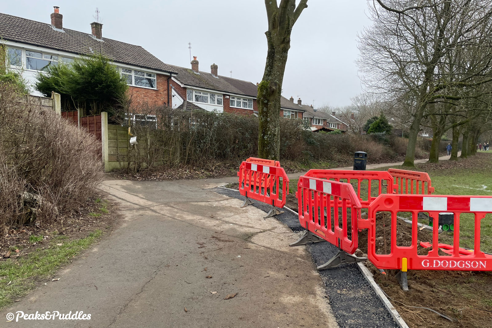
Further along, as mature trees sit tightly to the path, a brand new 3 metre route diverts off to the right.
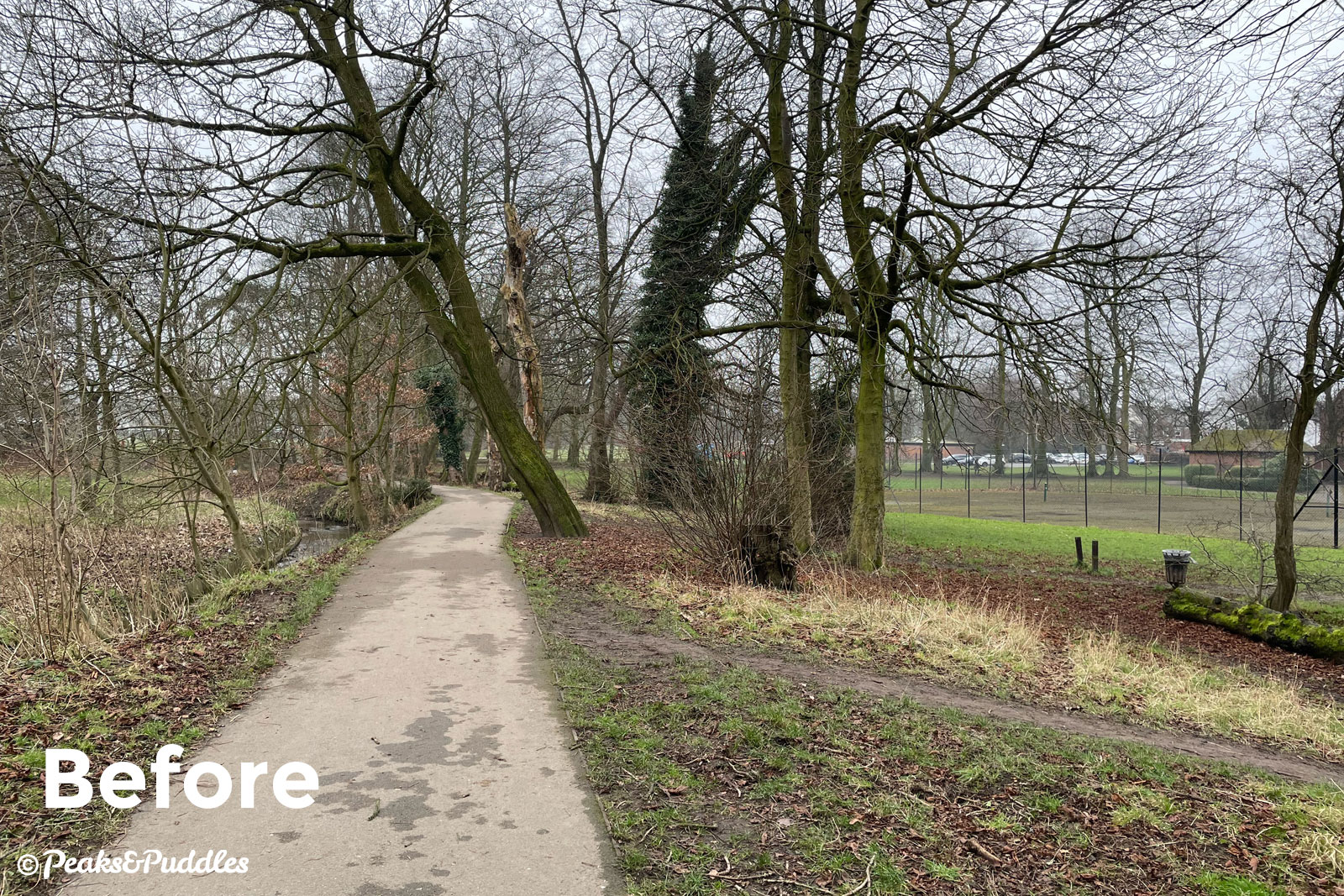
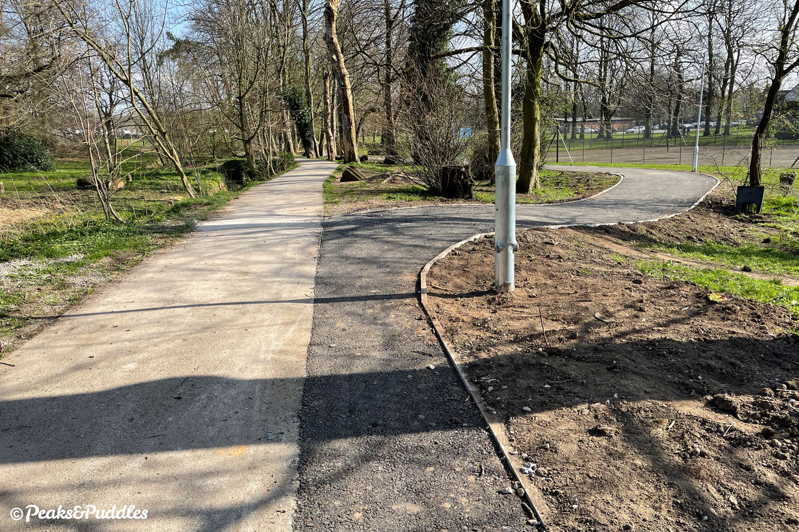
Hopefully the former route will be retained, allowing a welcome bit of separation as people cycling can take the new wider path to leave dog walkers in peace.
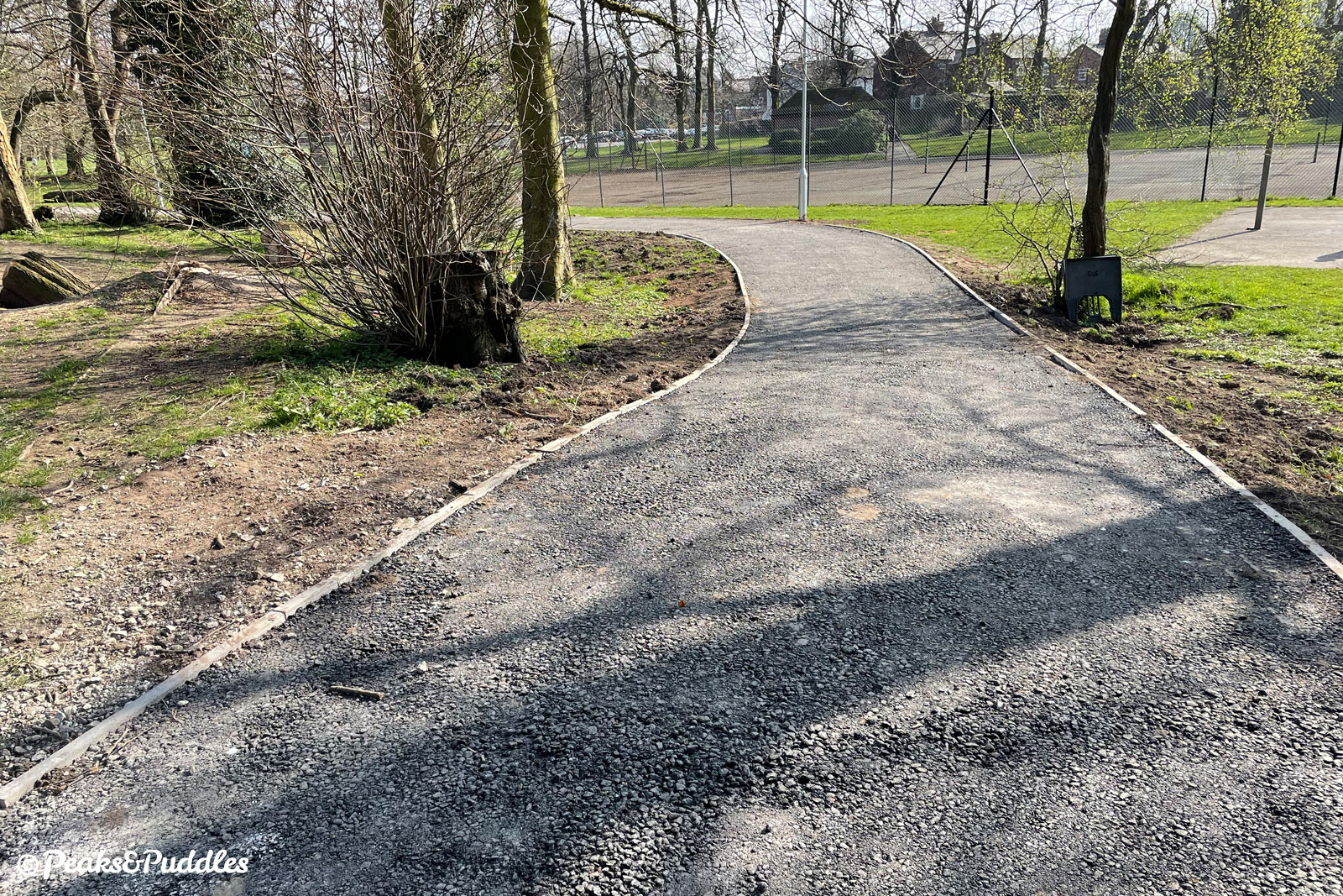
This then converges with multiple other routes at the centre of the park. From here, the Bee Network map showed improvements to the path leading south (right) towards the A6, but there’s now no sign of any work due there. Instead, the route continues east (ahead) around the side of a children’s playground.
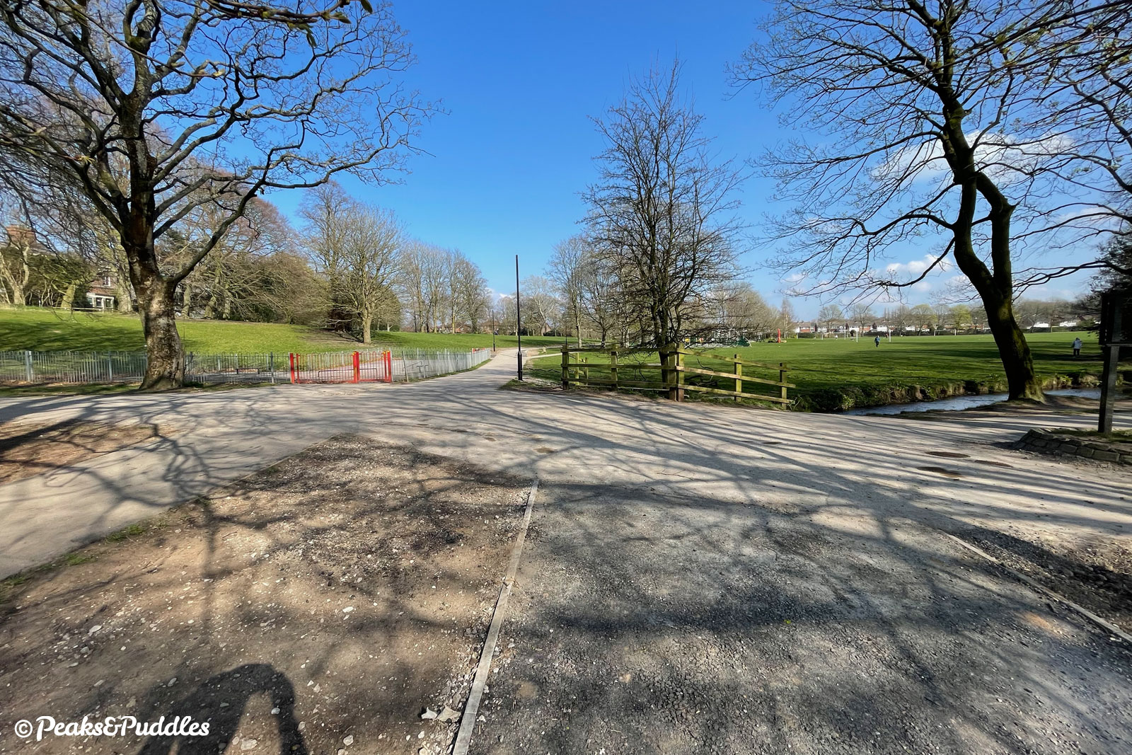
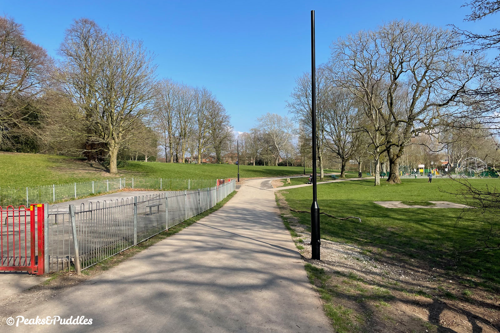
This path used to actually be signposted as “cycles only” — a welcome bypass to keep bikes away from the busy playground path — but has now, along with the rest of the path, been signed as a shared space.
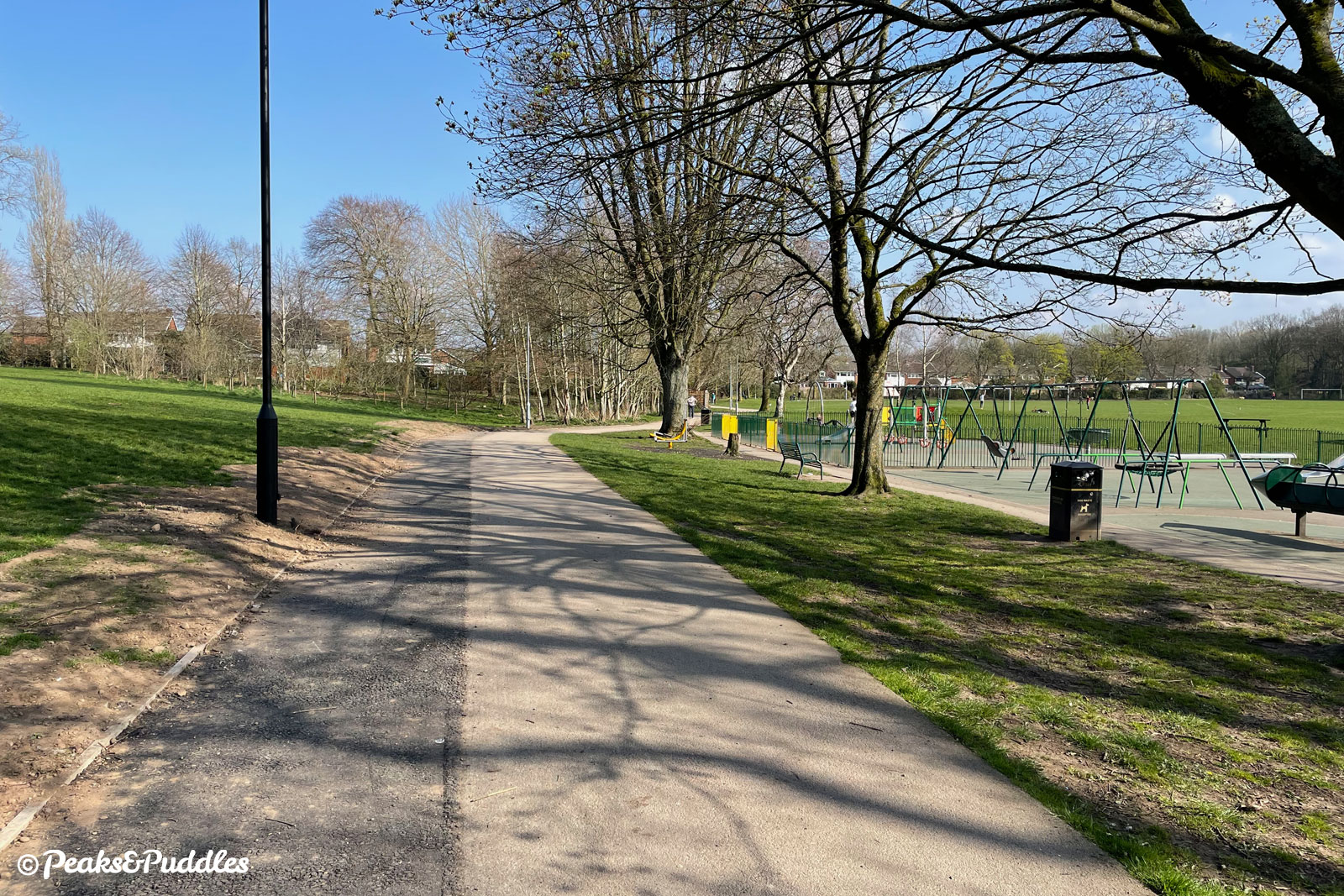
White line separation (always useless, of course) has been removed or left to fade and the existing path gains a few more comical centimetres to its width. I’m still assuming/hoping they plan to add a new top surface to the whole path width, once the street lighting and everything is in place, otherwise it’s a pretty lacklustre finish.
Then here, for a “Bee Network” scheme, for which a set of standards apparently apply, we hit a real bump.
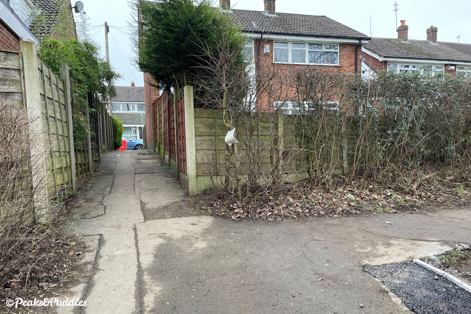
The onward route out onto Lingfield Avenue is unfortunately down a passageway narrow enough (perhaps 1.5 metres) to be single-file and not ideal for shared cycling at all. We can thank the housebuilders and council planners of the 1970s/80s for that.
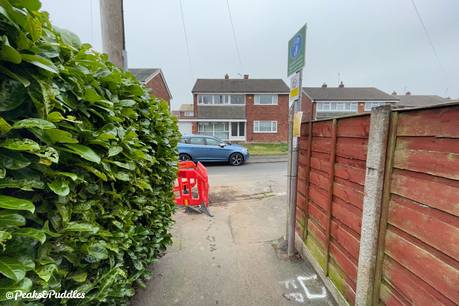
Popping out onto the maze of residential roads, there’s a new dropped kerb, but no-one’s thought to add parking restrictions, so let’s see how that goes.
And so far, that’s it. From Lingfield Avenue you can trace a very wiggly route to Torkington Road, for the primary school and a sometimes less than ideal 40 mph country lane out to Middlewood Way and Marple.
The missing link to the A555
When it was first announced and consulted on, this scheme also had another final link, upgrading and re-routing an existing footpath under the railway line (which links Hazel Grove to the Hope Valley line).
Emerging onto a golf club access road, this would’ve then linked in with the existing toucan crossing on the “new” A6 to get you onto the deserted old road and a lovely easy route not just to the A555 cycle path but the council’s brand new Bramhall Park route.
However, with part of the existing footpath being way too narrow for cycling and residents objecting to a new path diverted right behind their gardens, the council decided not to proceed with this.
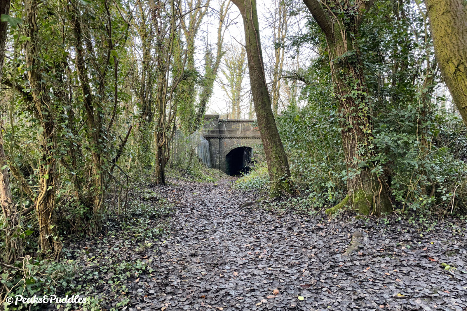
Somewhat undeterred, they have just signed off on a replacement scheme to upgrade the footpath as a footpath only, with flexipave surface, fixed drainage and works for potentially lighting the route in future. While I’d like to welcome any improvements to public rights of way, none of those interventions will probably really increase the small number of pedestrians using it versus its current state.
So now that the council is now no longer providing an official cycle connection from this whole side of Hazel Grove to the A555 junction and onwards, should they not be actively working on an alternative plan?
Perhaps actually a much more appealing route alongside the main desire line of the A6, rather than a dingy old railway subway? We were promised a cycle link here, so give us a link!
Looking at the road space available along the A6 and the general lack of foot traffic, a segregated cycleway (or even a widened shared pavement if need be) could easily be provided on the north side of the road between the main entrance to Torkington Park and the junction with the old Buxton Road.
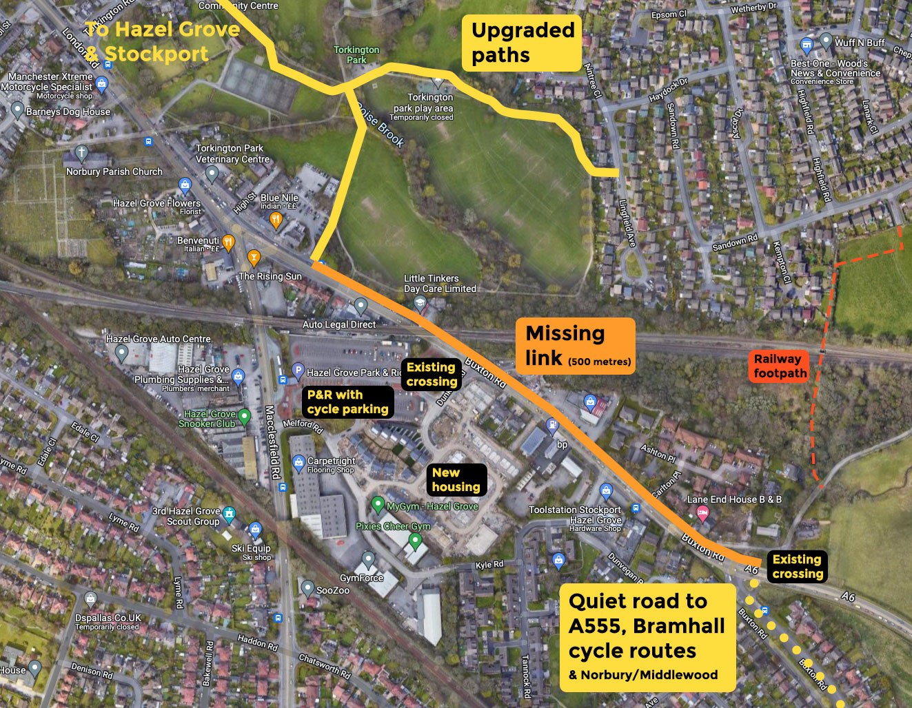
While every local cyclist (and scared but wannabe cyclist) would love a safe, protected route along the whole A6, this’d seem like a basic temporary compromise to connect the dots. It’d also give a link into the bus park & ride and an escape route for a brand new housing estate sandwiched between busy roads.
If Stockport Council instead chooses to do nothing here, as with its dithering over cycle links on the High Lane side of the A555, it will just leave another glaring missing link in the south east, devaluing all the schemes in the area.
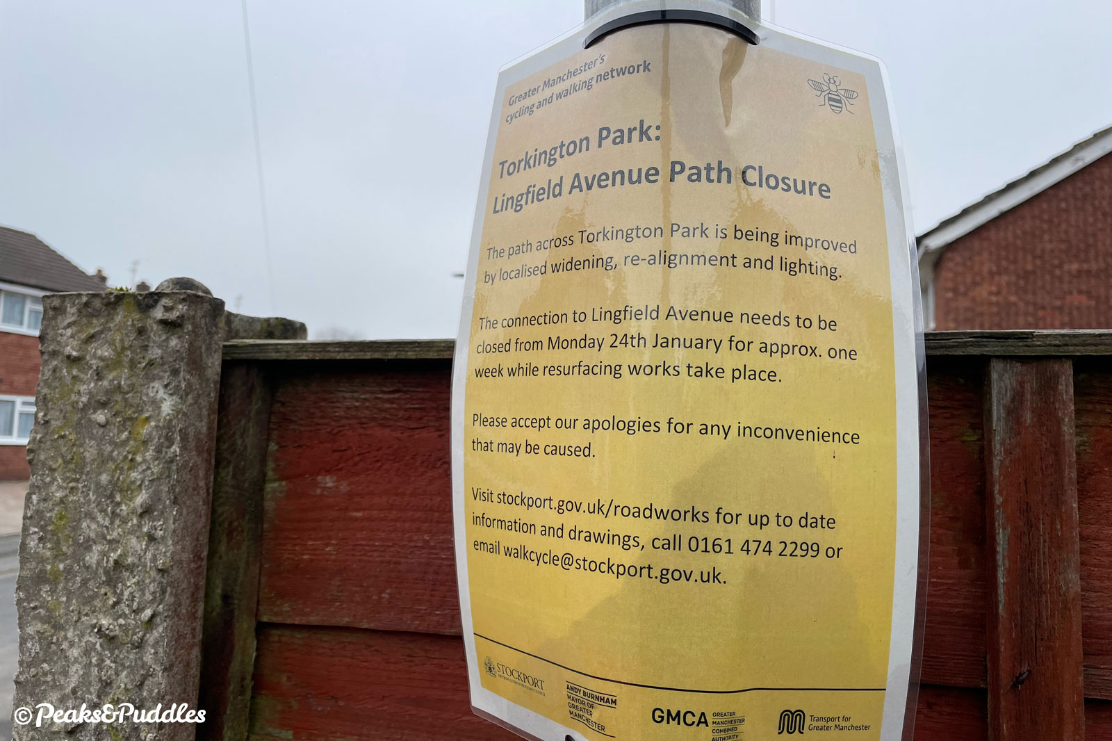
No further works programmed yet
So far, only plans for the Torkington Park works have appeared on the council’s online map, suggesting construction of other elements in the scheme has still not been scheduled. The official Bee Network website suggests the scheme will be completed by June 2022, so they’d better get a move on.
Some of these works are truly minor. On the link between Battersbay Grove and Brook Street, a barrier is supposed to be removed allowing proper cycle access. That’s it. They could’ve done this immediately at any time, but last I checked it’s still there (and seen here with a wedged cargo trike).
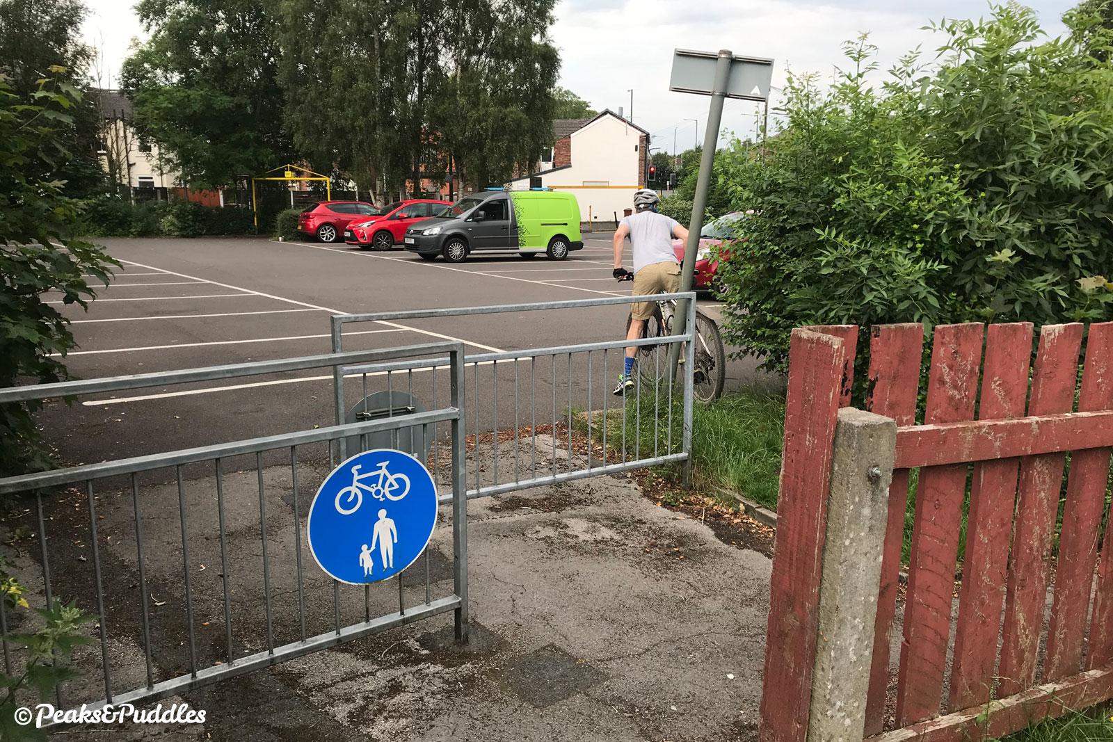
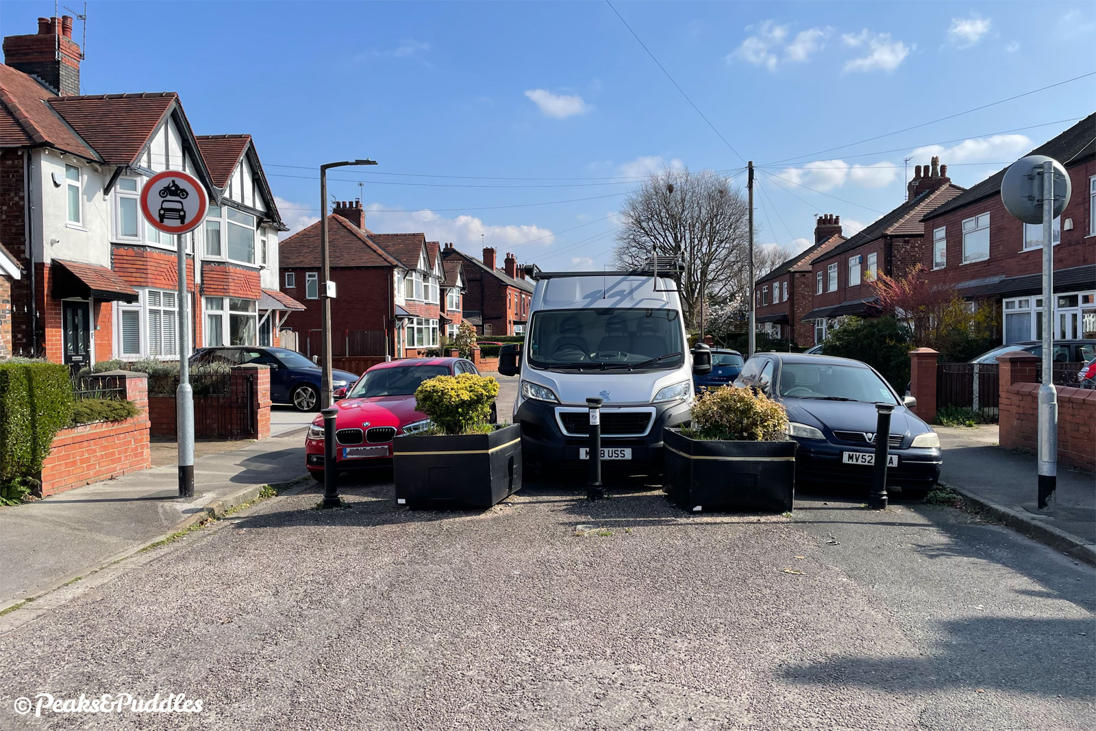
And over on Neville Street, improving a filter point to prevent it being blocked by parked vehicles. Three years later, here’s how it looked recently: no work underway. No way around except to mount the pavement.
There’s also no movement on perhaps the most important aspect: a parallel zebra crossing where a cycle path abruptly ends at Chester Road, close to Hazel Grove railway station.
This is something which you’d think a responsible council would’ve just funded themselves years ago anyway, rather than going cap-in-hand to the Bee Network bank.
Still not ideal, still not even that safe
Even with these tiny interventions, the scheme will be lacking for a “quiet” route with several safety issues to watch out for.
Back at Torkington Park, using that toucan crossing over the busy Torkington Road heading north, you’re spat out onto Hazelwood Road at a horrible point where you’ve got to simultaneously watch for vehicles both approaching around a blind bend to the right and turning (sometimes at speed) off the main road to the left.
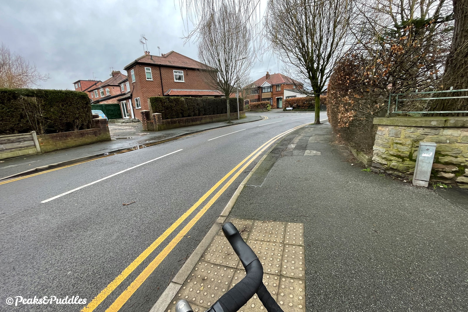
The council’s answer to this will be to tighten the corners of the junction and add a raised table — again, no work for this yet taken place or programmed. Although space to do much more is admittedly tight, it’s hard to understand why they wouldn’t also at least impose a 20 mph limit on Hazelwood Road.
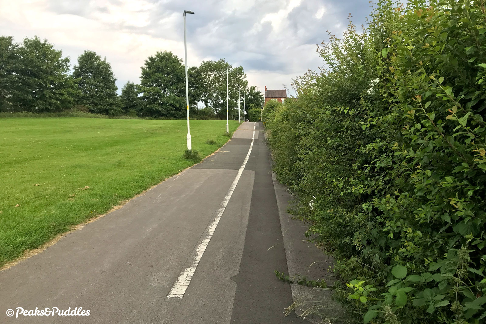
Meanwhile, on the west of the A6, the route uses the “allotment path”. Besides being no doubt incredibly unwelcoming in the dark (I’ve never wanted to try it), it’s often half-overgrown by vegetation and includes a farcical 90-degree blind bend.
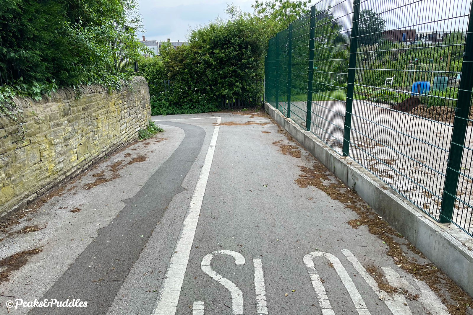
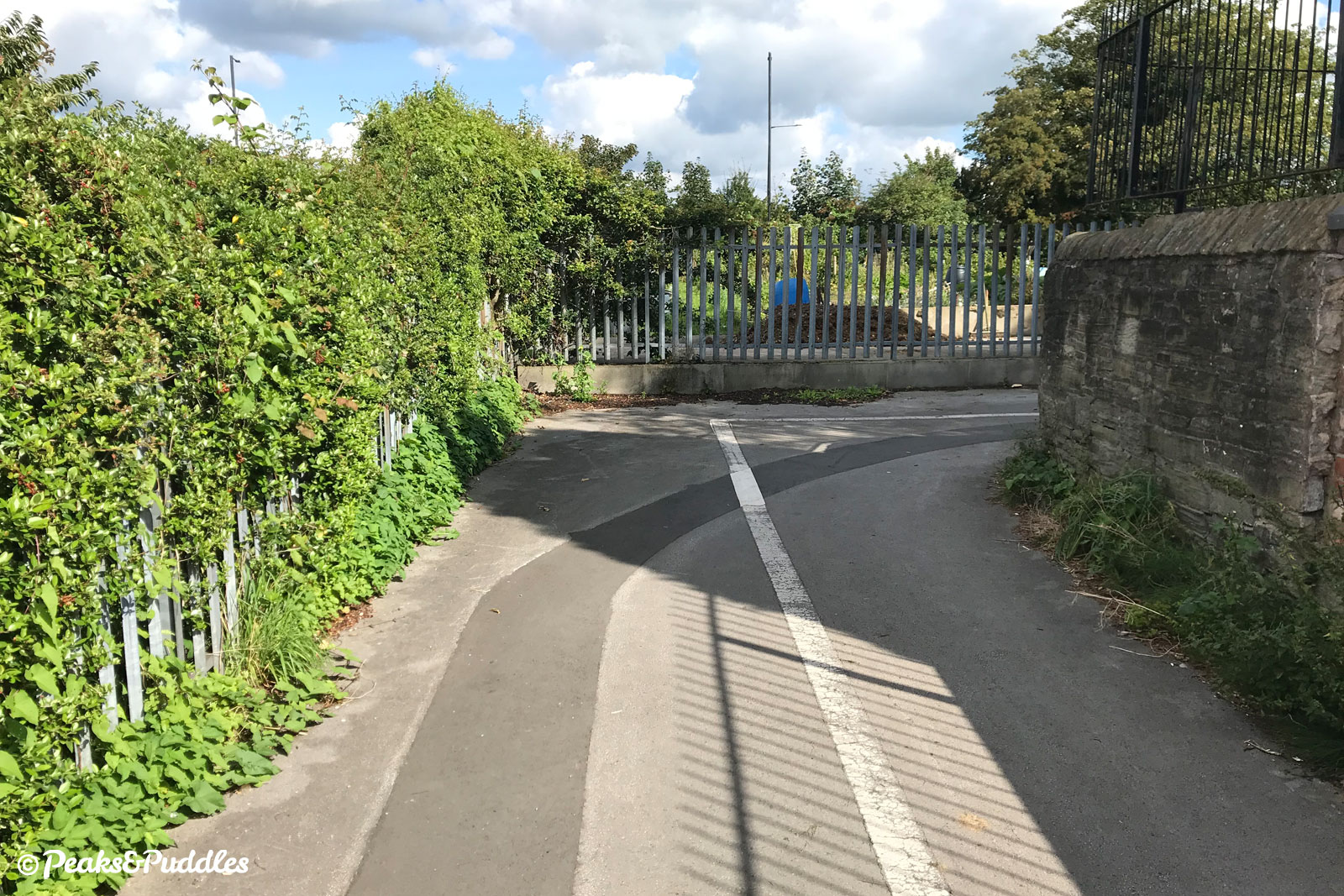
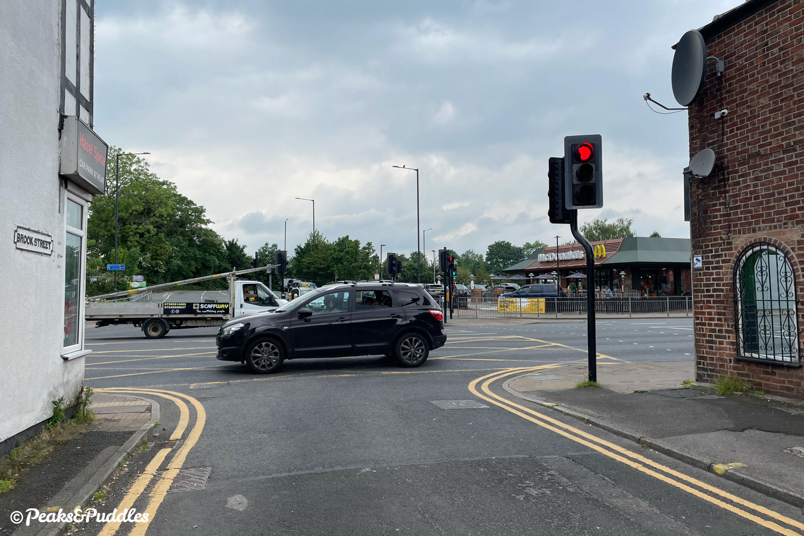
And if cycling in reverse, the wiggly route off this path provides no option but to join traffic queuing out of the McDonald’s drive-through at the main traffic lights, in order to cross straight over the A6 to Brook Street and Battersbay Grove.
One final compromise-too-far is the proposed “wheeling ramp” (yes, in the 2020s!) to be added to the footbridge over the railway line north of the station. Will that ever see the light of day?
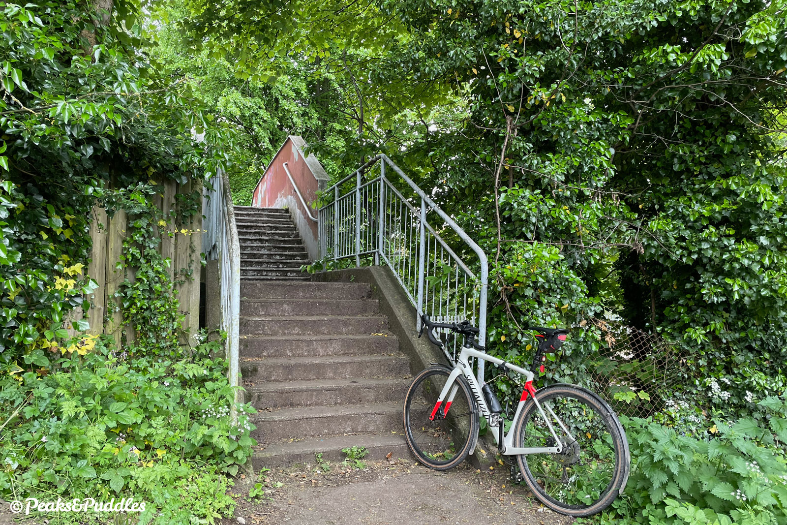
The railway severs this part of Stockport so badly, with the only road bridges narrow and unpleasant, that the council and Network Rail should really be looking at a brand new, fully accessible bridge somewhere around here as a priority.
So bad it’s bad
I do wonder if part of the reason for delays to this scheme is that it’s just… not very good. During the first round of Emergency Active Travel Funding from the government early in the pandemic, when other councils were actively coning off whole lanes of actual roads for safer cycling, Stockport submitted an “A6 Hazel Grove Parallel Emergency Cycle Scheme” for funding.
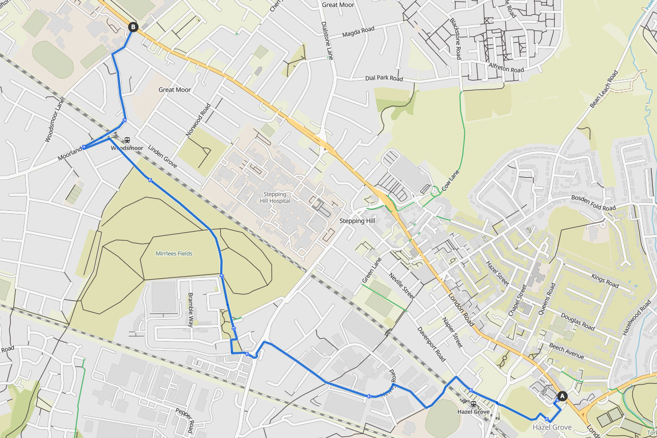
This basically consisted of the same wiggly route — wheeling ramp over the steep footbridge included! — then leaving you to fend for yourself at Woodsmoor. (Remember that the four/five-lane A6 has no cycle facilities south of the Town Hall. None!)
No, really — despite the Department for Transport asking for “meaningful reallocation of roadspace”, Stockport decided to submit this route for £93,000 of funding as a genuine way to achieve major modal shift to cycling on the A6 corridor.
Transport for Greater Manchester, who administered the funding for the whole of Greater Manchester, scored the scheme so badly (yes, even worse than the rather poor Heaton Chapel parallel route, at 7 points versus 12 — see the FOI request here) that it received no funding and was quietly glossed over.
Not enough, not fast enough
So that’s the story of the Hazel Grove Links, which by any measure should not be considered worthy of the Bee Network as promised, but may be very (very) slightly welcome in the complete absence of anything else, whenever they’re actually completed.
Ultimately, the question to Stockport Council remains: when are you going to give people a few metres to safely cycle along your whoppingly wide A6, instead of this nonsense?
- If you’ve enjoyed this trundle, please consider supporting the several cups of coffee it took to put together, or browse my rather more scenic local cycle routes!
