Closures along two Derbyshire cycling and walking trails are underway, with disappointingly little advance notice given before the works began.
Sporadic route closures seems to be the theme of 2025 so far. Early closures for tree works along the Monsal Trail and Thornhill Trail were very highly publicised and finished early, while that latter at least cannot be said of the ongoing B5470 situation.
These two current trail closures however highlight a recurring problem of off-road path closures being seen as somewhat unimportant by the powers that be. They can actually be more inconvenient and disenabling for many peoples’ lives than a major road closure, pushing people onto potentially less safe routes or stopping travel entirely.
Peak Forest Tramway Trail — Closed until 9th April (hopefully)
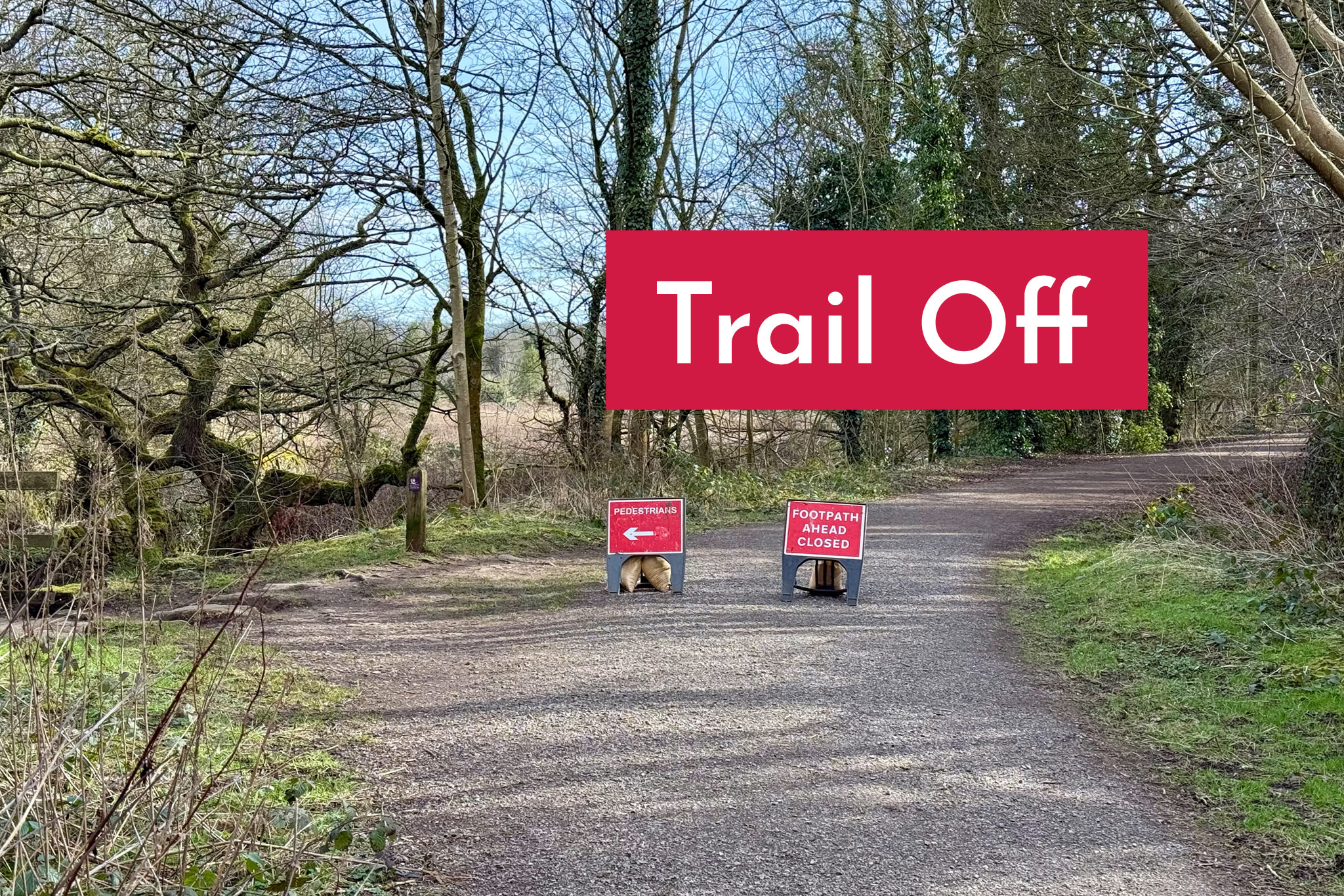
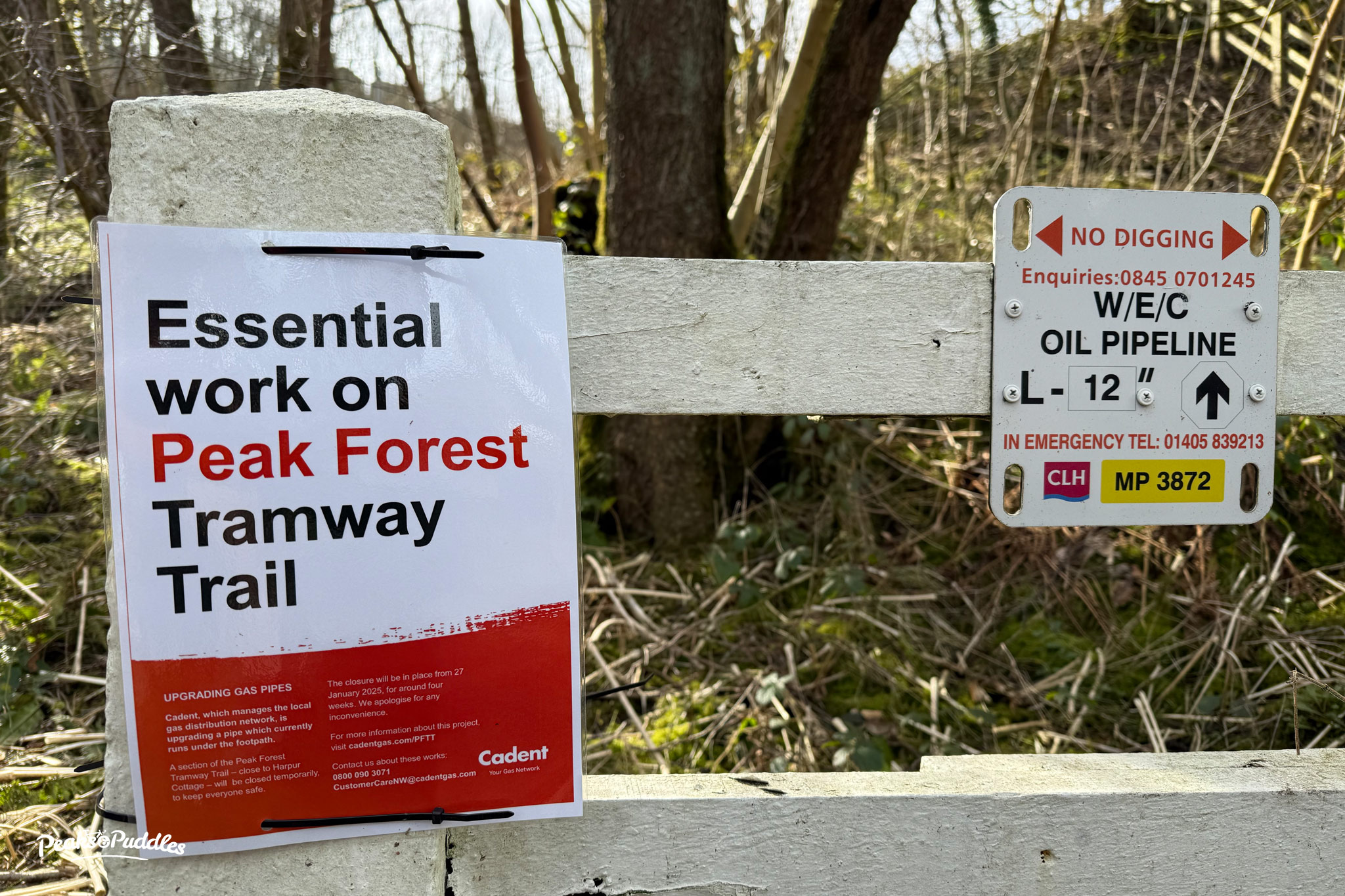
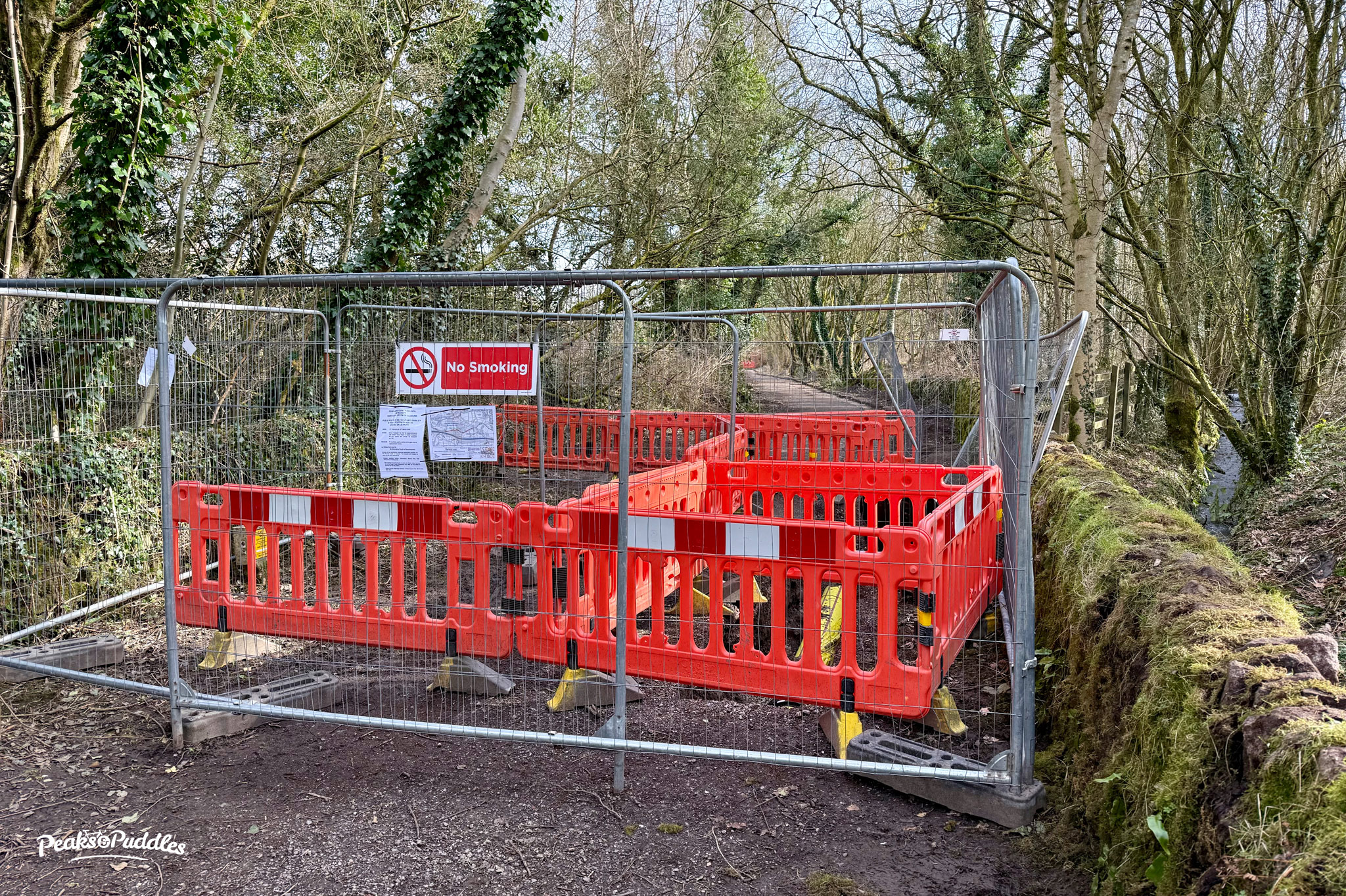
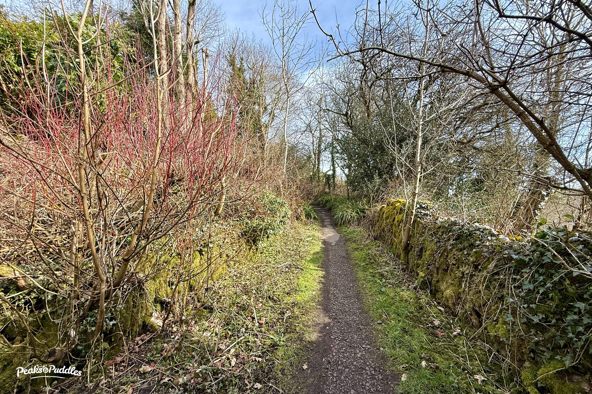
Cadent have been doing gas mains replacement where pipes run directly under the Peak Forest Tramway Trail between Bugsworth Basin and Whitehough. With no wider advance warning beyond maybe a few small on-site notices, this has blocked an essential off-road link for about two months.
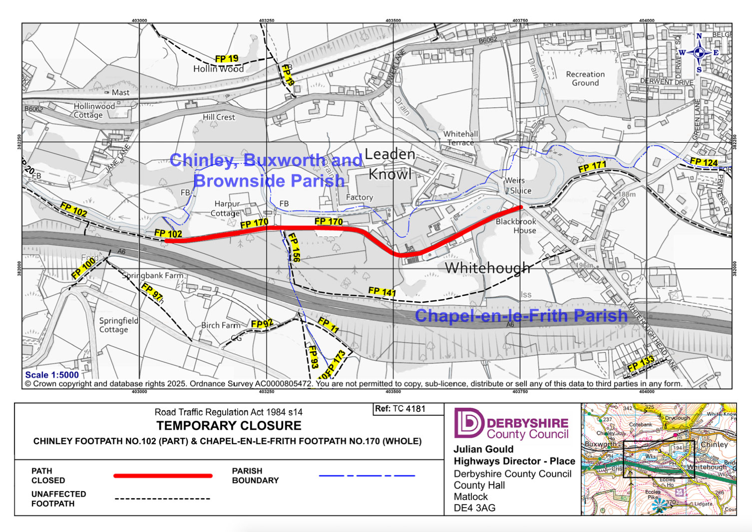
Unlike if this were to happen to, say, the A6 which runs directly parallel to the south, the blockade went up in a matter of whisper and speculation. The only online notice was oddly a highways permit stating “no carriageway incursion”. No footpath closure was recorded at all, despite the route being obstructed.
On 18th February, I asked Derbyshire County Council Rights of Way by email if they knew anything, receiving only a copy of an email forwarded to someone else, asking if they knew anything. “Please see the below, I cant seem to find anything for this closure on the website?”
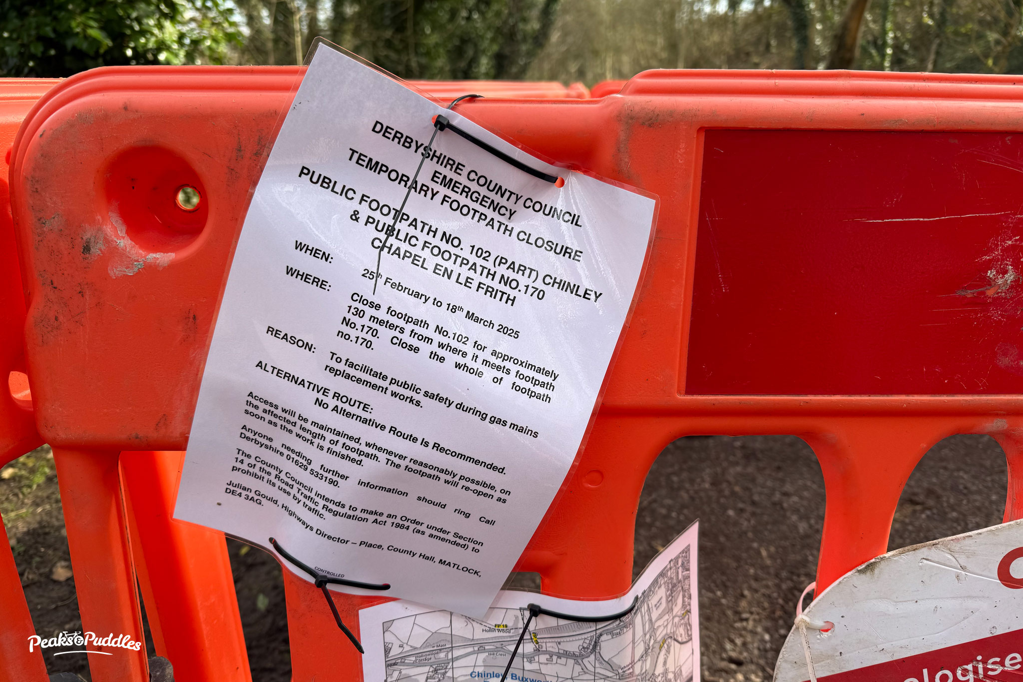
A week or so later, a closure order for the path (officially Chinley, Buxworth And Brownside Footpath 102) magically appeared. They never got back to me to confirm. Even if Cadent screwed up their obligations here, there’s since been no public communication by DCC about the route closure, despite it forming part of their “Key Cycle Network”.
Originally scheduled for four weeks from late January, then due to end on 18th March, work has now been extended again until 9th April. Councillor Ruth George (who’s been admirably communicating the closure where DCC have completely failed) posted that Cadent say this is due to issues with valves and a specialist company being brought in to supply.
I’ve always tried to champion this little trail and this closure shows just how important it is. There is no official diversion. The lane to the south through Buxworth and Back Eccles is incredibly hilly. The B6062 to the north is not the worst B road but makes for a long slog uphill to Chinley mixing with (sometimes speeding or impatient) traffic. It’s probably worse for walking, as one section has no footway.
The A6 dual carriageway directly to the south has no cycle infrastructure nor footway — that’s kind of the function the Peak Forest Tramway here provides, even if DCC don’t realise it (as the only off-carriageway alternative to a major A road they should be working towards its improvement and extension accordingly, but continue to leave it on the back burner).
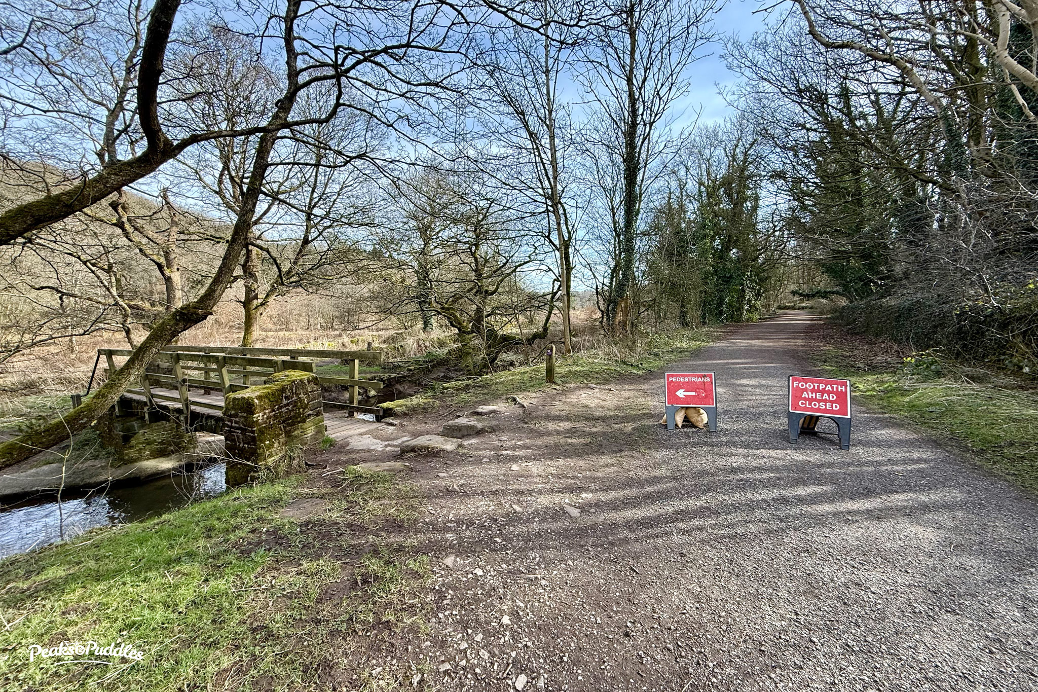
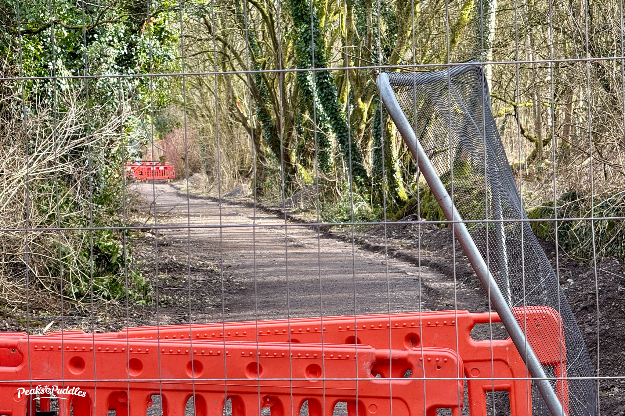
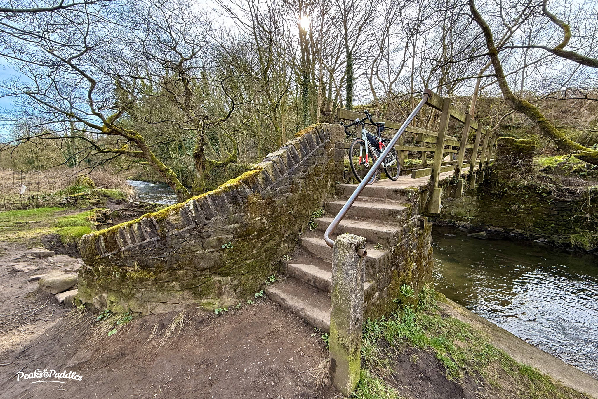
While I saw a few reports early on that the closure could potentially be cut through, that wasn’t the case any time I’ve tried; the path was thoroughly blocked. The best alternative is to cross the footbridge, if you can, and head up the snazzily titled Jane Lane. This gets steeper (and is a footpath) but is rideable if there’s no one walking, and cuts out a good chunk of the B6062 to Chinley.
Hopefully the trail itself, which was only resurfaced a couple of years ago, will be relaid to an acceptable standard and not to a “utility company special” mess.
I won’t take this short trail for granted again. Maybe we should now push harder for the rest of the path to Charley Lane and Chapel Milton to be brought up to trail standard?
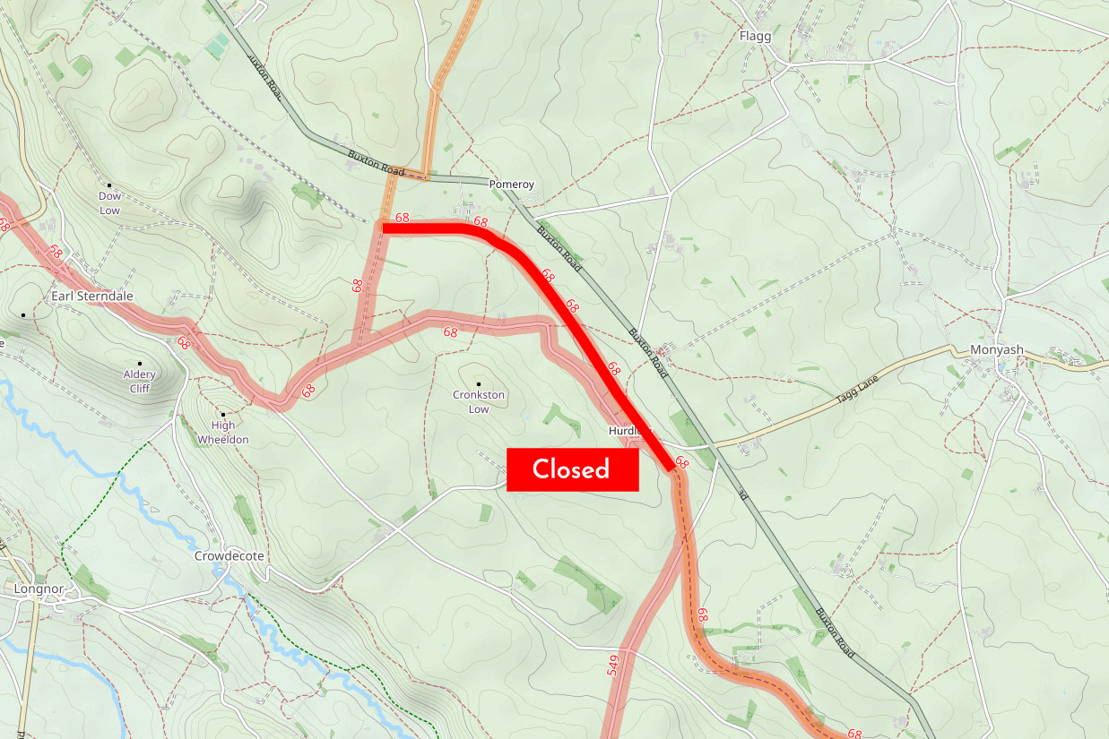
High Peak Trail — Closed at Hurdlow “from 3rd March for around 3 to 4 weeks” (maybe)
The most northerly 1.5 miles of the High Peak Trail between Hurdlow and Pomeroy has been closed for resurfacing. Not a bad thing, and this one’s not hard to divert around using the scenic but slightly hillier lane to the south. Only the Hurdlow car park being closed during the work has probably caused some inconvenience.
Again though, notices only went up on site not long before the work began and it wasn’t communicated anywhere online; the official trail closures page only listing it after work began. I can’t find an official Derbyshire closure notice for the path number, Hartington Middle Quarter BW 43.
Not even the Peak District National Park Authority seems sure of the exact closure end date, so works may well be over or nearly done. The trail north of Parsley Hay often gets overlooked by riders and has always been a little bumpier and narrower, so it’s good to see it getting attention. But why do these improvements always seem to happen by surprise at short notice, communicated by whispers and approximations?
A wider issue here is that, whereas the roads have one.network, there seems to be no national equivalent for rights of way and adopted paths and trails. Finding out about closures often means hunting through council web pages designed to be hidden; in the case of Derbyshire then drilling down by district.
A browsable map of closures would be a revelation, but would also require the authorities and government to actually see the rights of way network as the integral part of our transport infrastructure that it is. In the meantime, if Derbyshire is serious about having a “Key Cycle Network” it could at least have a centralised page listing closures of major routes like these.