Climbing from Bollington and Pott Shrigley through the Old Brickworks of Bakestonedale Moor is one of the Peak District’s most famous cycling climbs, but besting this Cheshire challenger needn’t be quite as fearsome as you might think.
Route details
- Distance
 18.4 miles / 29.6 km
 - Elevation Gain
 507 m / 1662 ft
 - Time allow 2 hours
- Difficulty
 Challenging
 - Suited to
 Gravel Bike
  Hybrid Bike
  Road Bike
 - Notes Other Bikes: route is accessible to all however, being fully on-road with long climbs, may not be best-suited to other types. Three standard gates on canal link.
- Suggested Start SK7 6NW SJ 9465 8697
- Places Adlington, Bollington, Booth Green, Cheshire, Cheshire East, Disley, High Lane, Higher Poynton, Kettleshulme, Lyme Handley, Middlewood, Pott Shrigley, Rose Hill, Whitely Green, Wood Lanes
- Attributes Accessible by train, Bridges, Car parking, Circular loop, Dales, Ideal for electric bikes, National Cycle Network, Pocket Guide available, Pubs and cafés, Railways, Rural heritage, Steep climbs, Towns and villages, Tunnels, Views of hills and peaks, Views of open countryside
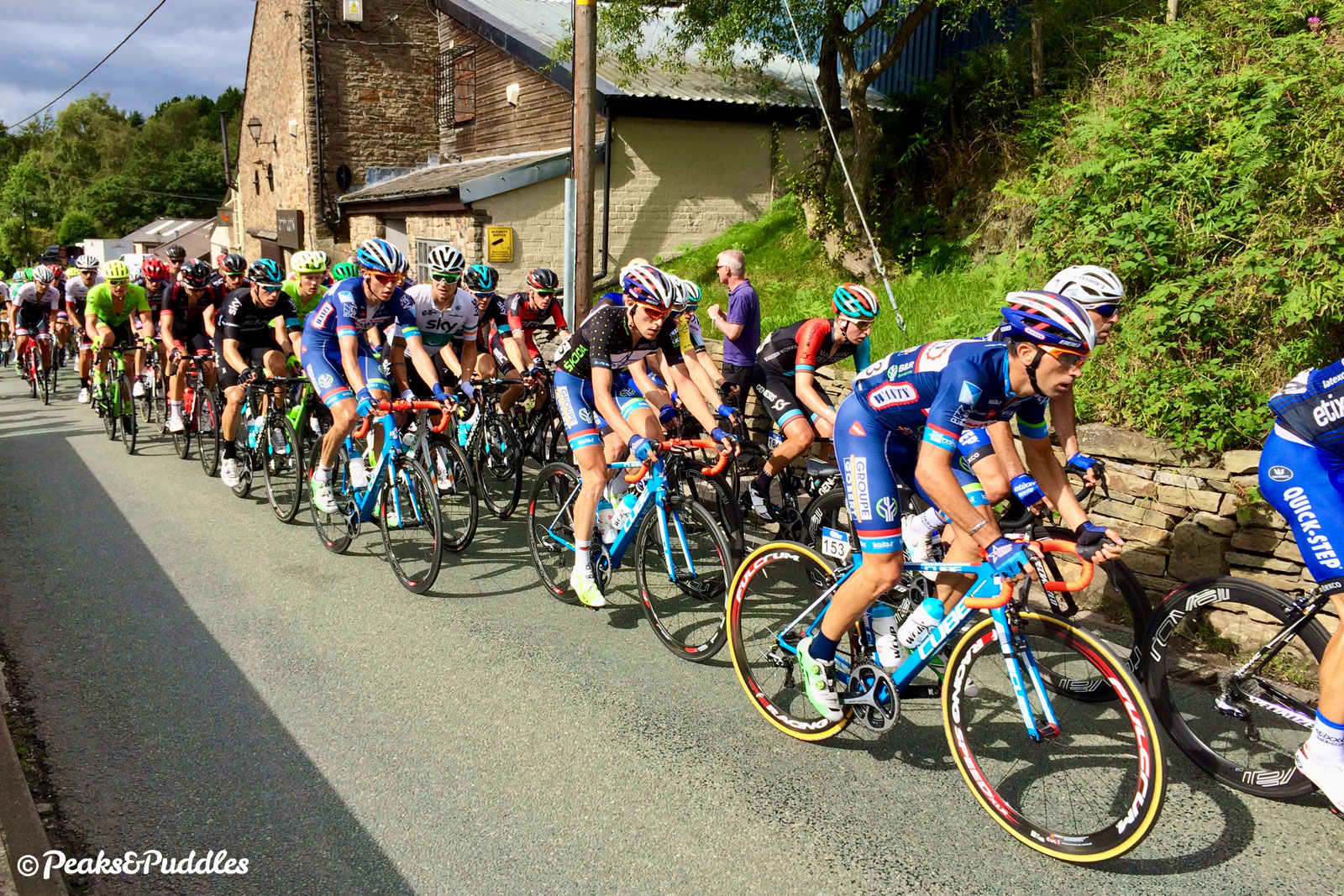
First, let’s be honest: there is nothing “beginner” about the Brickworks climb. This is a hefty, strenuous, two-mile climb up into the Peak District National Park, eternally loved by serious “roadies” and scaled by the Tour of Britain race.
However, if you’re considering trying it for the first time, it might not be the extended gradient that bothers you but the sometimes hostile roads either side of it. Avoiding those as much as possible, this route attempts the most manageable Brickworks loop possible, climbing up from the calm of Middlewood Way.

The name Bakestonedale Road is rarely spoken by the cyclists who love it. Instead the climb takes its name from the Old Brickworks, an unlikely hive of industrial activity which sits roughly one third of the way up.
Now housing small businesses, the estate began life in 1820 as a small brickworks, tapping into the ideal seams of clay and coal which were mined under Bakestonedale Moor to the north.
It was taken over by William Hammond in 1886 and expanded, remaining in the family and coming to importance during the two World Wars, when production was increased and women were taken onto the production line to ensure a continued output. The mines were closed in the 1950s and their shafts are now eerily dotted across the moor with their square concrete caps.
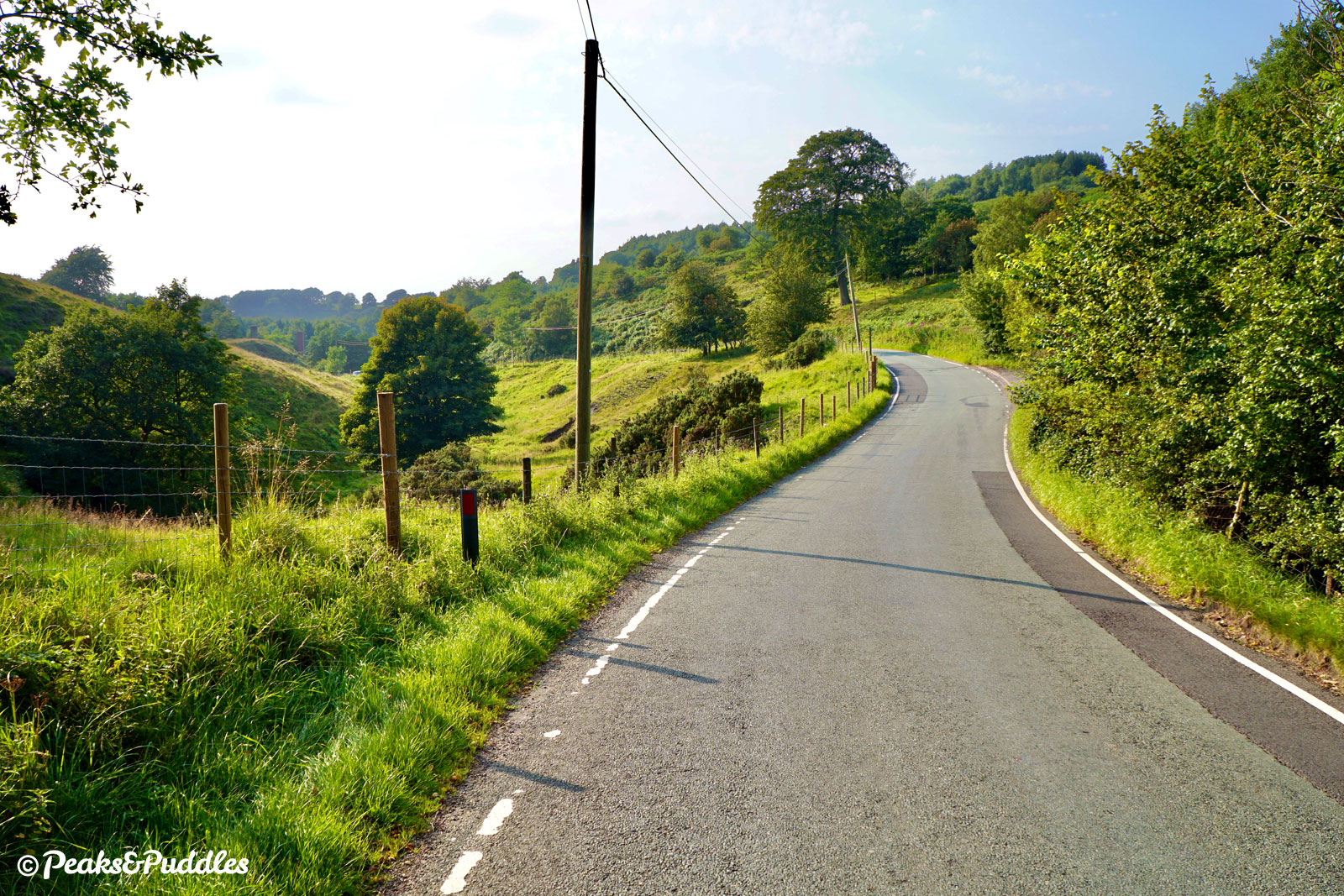
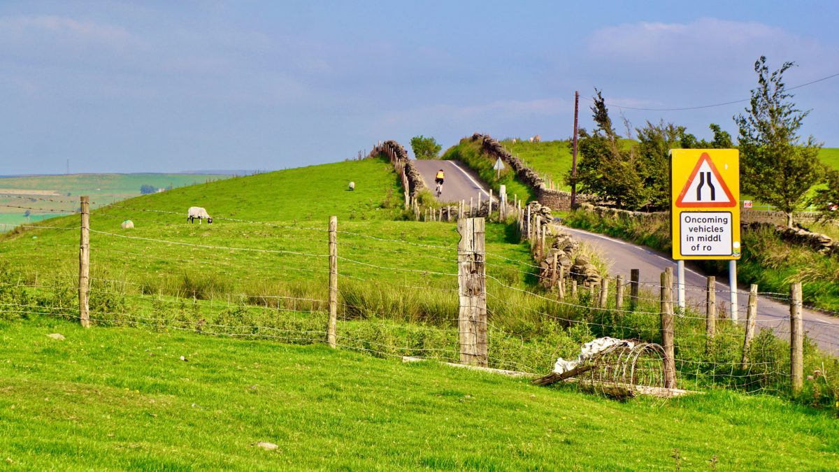
Above the old mines, past Bakestonedale Farm, is where the climb becomes a truly wondrous bit of cycling. Here it follows only telephone poles across the desolate, green landscape, before a turn below Brink Brow reveals a spectacular final run above Harrop Brook with views to the Tors of the upper Goyt Valley.

The downside to Bakestonedale Road is where it leads you. Though the view over Todd Brook between Sponds Hill and Charles Head is spectacular, the only onward route is the fast B5470 Macclesfield to Whaley Bridge road. Continuing on this, all the way up the painfully unpleasant climb through Kettleshulme, or even over towards Rainow, might be where some go wrong — the key for an enjoyable ride is to surely touch it as briefly as possible, and turn off at the first chance.
Though Higher Lane throws you back into an immediate hill climb, it’s a far quieter road and the view from the summit is absolutely sensational. In a single glance, the full house of Kinder Scout, Chinley Churn, Eccles Pike, Windgather Rocks and the rounded tops of Cats Tor and Shining Tor stretching away behind. You don’t get that gasping away amongst the impatient traffic on the B5470.

Getting to the start of the Brickworks can be made a little better, too. The obvious Shrigley Road, leading straight up from Adlington past Shrigley Hall, is well-traversed by cyclists but can feel an unpleasant place to be when Cheshire SUVs race up behind. Instead, this route wiggles through pretty Bollington’s back lanes, uses the very first part of the Blaze Hill climb (a real horror attempted in full), then turns to approach Pott Shrigley on a far quieter lane.
Much of the lead-in is taken care of thanks to the traffic-free Middlewood Way railway trail, while this route also includes an energetic but worthwhile diversion to avoid the A6 between Disley and High Lane, closing an heroic loop from suburbia to the Peak.
Route map
The route stats featured here are automatically generated by Komoot. For the most accurate guide, please refer to the route details above, based on actual rides recorded by Strava.
Where to start
From Marple, Macclesfield and anywhere connected to the Middlewood Way, simply join this trail and head towards Bollington (see the separate route guide for more tips). While the Alan Newton Way also links into the start of it, from Hazel Grove, Offerton and inner Stockport it might be preferable to use the rural Torkington Road as a route out from the residential back streets, assuming you want to avoid the A6.
Disley on the very north eastern edge of Cheshire makes an ideal alternative starting point. The route passes through the main junction of Fountain Square. An easy route to here is the Upper Peak Forest Canal, leaving at Bridge 26 on Redhouse Lane and turning right into Hollinwood Road, which leads up to the A6.
(Tip: If approaching Disley from this direction, to avoid being sandwiched in the middle of the major junction trying to turn right into Jacksons Edge Road, turn left before the traffic lights into the small slip road beside the old fountain. Then turn right, so you’re simply going straight across the junction when the lights go green.)
By train: Both Middlewood railway station and Disley railway station are right on the route, with services on the Buxton to Manchester Piccadilly line, though not all trains stop at Middlewood. Rose Hill Marple railway station and Macclesfield railway station bookend Middlewood Way.
By car: Disley railway station car park or the small Disley community centre car park accessed off Buxton Old Road are good starting points, or see the Middlewood Way cycle route guide for more parking spots along this part of the route.

Things to note
- The Brickworks is a remarkably consistent climb from start to finish with little let-up. From Pott Shrigley, it climbs for 3.2 km (2 miles) and totals 171 metres (561 ft). There are several places to catch your breath where it widens out, though: notably the Old Brickworks industrial estate itself and beside Bakestonedale Farm. Just beyond the summit, the view over Gnathole Brook towards Kettleshulme provides a perfect celebratory stopping point.
- From the top of the Brickworks, the route briefly joins the busier B5470, with an immediate drop and very sharp bend through Gnathole Brook requiring much care and keen braking. There’s a similarly sharp drop into a hidden dip on Higher Lane which follows — again, good grip on the brakes and handlebars required!
- On the return leg via Mudhurst Lane, watch out for the uneven surface, especially around grids in the road. Heading down Buxton Old Road into Disley, things deteriorate further with some incredibly harsh speed bumps.
- The lanes featured here are all mostly quiet, sometimes even busier with bikes than cars, but it can definitely help to avoid peak rush hour times when a few too many eager motorists can spoil the peace.
- It’s possible to cut out the entire extra climb over Jacksons Edge by simply cycling down the busy A6. However, with its terrible current road layout through High Lane, with stop-start painted cycle lanes, that’s not something you’ll find recommended here. See the extra hill and the wiggly backroads as part of the adventure.
- See the Middlewood Way cycle route guide for things to note about this section of the route. You’re not on the Brickworks yet, so do take it easy around other users here and on the very short section of canal towpath.
Found this guide helpful?
Please consider chipping in the price of a coffee to help pay the bills and support my work. Or become a Peaks & Puddles + supporter to get access to exclusive routes and pages in return.
Route stage-by-stage
- Starting out on Middlewood Way, from just off Torkington Road there’s a leafy 9.9 km (6.2 miles) of traffic-free, unrestricted cycling ahead, all the way to Bollington. Along the former trackbed of the Macclesfield, Bollington and Marple Railway, the trail passes the disused stations of High Lane and Higher Poynton, the unusual, still operational Middlewood station and several beautiful views of the Cheshire landscape, whenever the line emerges from its damp, nature-rich cutting. After crossing the impressive Bollington Viaduct, with views to the left of the hills about to come, pass under one final bridge.
- Just after the bridge, turn right onto a narrower ramped path, doubling back up to a gate. Turn right onto Hawthorn Road, now crossing above Middlewood Way, and climb briefly between houses. Ahead slightly to the right, turn left through a gate onto the Macclesfield Canal for a quick pootle along this well-surfaced towpath. At the first bridge, number 27, don’t use the steps but continue underneath, with the preserved chimney of the mighty Clarence Mill coming into view — a worthwhile diversion, with a café stop over an easy ramped bridge. Otherwise, turn left through a wide gate then turn left onto Hurst Lane, doubling back over the waterway. Follow this quiet lane as it climbs the side of the River Dean’s valley, getting narrower as it bears left.


- Meeting a t-junction, turn left onto Grimshaw Lane then left into Chancery Lane, incredibly narrow for a two-way street. Follow the lane downhill to the right, then left becoming Lord Street. After a steep, swift descent, follow in a sharp left onto Church Street. Nearing a junction ahead, instead turn right into Chapel Street then turn left into Silver Street, cutting out an awkward roundabout. Turn right onto Ingersley Road and, as the stone cottages peter out at a pub, follow the road in a sharp left onto Smithy Brow. This is in fact the start of another infamous Bollington climb, Blaze Hill, an immediate and solid gradient that continues on up (featured in Cheshire Mountains of Macclesfield) — but not for this route. At the first house straight ahead, turn left and the lovely swooping Spuley Lane drops briefly through Berristall Dale at the foot of Harrop Brook. At an angled t-junction, turn right onto Shrigley Road. The tiny but picturesque village centre of Pott Shrigley with its parish church and bright red phone box is soon ahead.
- From Pott Shrigley, turn right into Bakestonedale Road, signposted Old Brickworks (take care with traffic approaching from left). The Brickworks climb has begun! It first climbs briefly around the dale towards Overheyes Farm and then again between wooded banks, riders perhaps wondering what makes this strenuous climb so special. The Old Brickworks are quickly encountered, a curious collection of industrial businesses with one very popular, shrewd newcomer in the form of an artisan coffee roastery. Leaving the stone buildings behind, the road returns immediately to the rural landscape, climbing directly beside Bakestonedale Moor, where the clay and coal to fire the bricks was painstakingly mined. Alongside banks of ferns and a cackling stream, between beautifully rounded knolls and cheered on only by telephone poles and sheep, the road rises up fantastically, gloriously into the Peak District landscape.
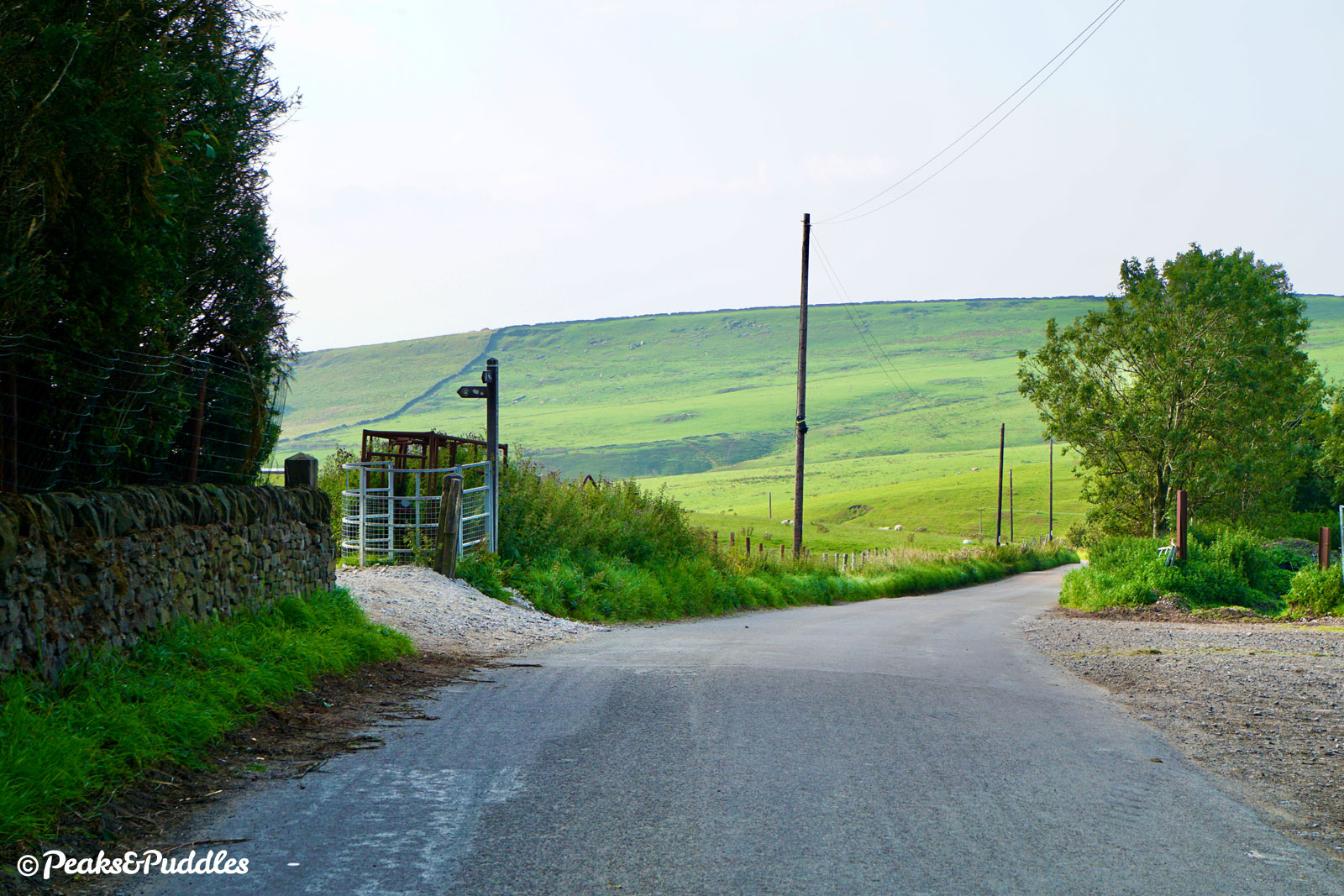
- Rounding a challenging bend, the gradient eases off briefly for a long straight below Ellis Bank, as Bakestonedale Farm comes into view ahead. Twisting immediately to the right after the farm, perhaps the most challenging part of the climb kicks in — the gradient just that much keener and for that much longer. The kink in the road at Brink Farm is the breathless, gasping, “nearly there” marker of the route. Around the bend, the road suddenly levels out, buildings, trees and the mounded top of Brink Brow briefly hiding a stunning panorama that then reveals itself: the Tors of the Upper Goyt Valley and the distant pinnacle of Shutlingsloe. As if now willing climbers to avoid dawdling at the view, the road drops gently, then rises again. See that tiny little hill ahead? That’s it, top of the Brickworks! The roadside beyond has been trodden by an endless stream of sweaty cyclists, capturing the stunning view through the hills ahead to the High Peak.
- When ready to go beyond the Brickworks summit, continue to the t-junction with the fast B5470 Macclesfield Road. Visibility here over the brow of the hill is not the best, so take care turning left, immediately down a plummeting hill into Gnathole Brook. Apply brakes well before the sharp bend at the bottom, if not all the way down. Continuing to coast downhill, the triangular warning sign of a road joining ahead is the point to prepare to turn left, at a junction hidden until the last minute by vegetation, into Higher Lane. Even if slowing to turn, it’s a good idea not to lose too much momentum: there’s an immediate hill climb ahead. The road climbs for one challenging kilometre up around the side of Reed Hill; the gasping turns of each wheel hopefully placated by the brilliant view over Todd Brook and Kettleshulme. Yes, this really is still Cheshire.
- Over the summit of Higher Lane, Kinder Scout comes into view in the far distance to the right, surrounded by Chinley Churn, Eccles Pike and Whaley Moor. A shrieking descent down past Higher Cliff Farm follows, into a surprising dip over a bridge where g-force will certainly be felt if brakes are not keenly applied. But where there’s momentum, use as much as possible to get up the quick rise which follows. Narrowing suddenly, the lane twists over a second “bridge of doom” (watch carefully for any vehicles approaching) and then turns right for another fair climb. Eventually pedalling up to Dissop Head and Cock Knoll, Mudhurst Lane unfolds satisfyingly ahead. With views now back over Greater Manchester, the lane rolls and twists gently downhill with sensational views. Lyme Park and its Cage are prominent to the left, along with Bollinhurst Reservoir, while the rugged Black Rocks are up above to the right.
- Meeting a t-junction beside a beautiful old Cheshire fingerpost sign, turn left and follow Buxton Old Road swiftly downhill into Disley, over some particularly hostile bumps. Approaching the Fountain Square traffic lights, take the second (centre) lane to continue straight ahead, up the immediate climb of Jacksons Edge Road. Beyond a set of one-way traffic lights at the top, the road descends past the golf course. Just as the 20 mph speed limit begins, turn right into Wybersley Road. A far-reaching view of the River Goyt’s valley towards Strines and Marple Bridge opens up. (If returning to Marple, this road along the ridge can be followed all the way for a scenic finale — featured in Lyme Lanes.)
- Before the bend ahead, turn left into Thornway, suddenly entering darkest suburbia. Yet even here there’s a view, over the south of Greater Manchester with the long, low rise of Alderley Edge just visible as the road suddenly twists downwards. At the bottom, pass the first cul-de-sac on the right then turn right into South Meadway which becomes simply Meadway, passing more bungalows. At the t-junction, turn right onto Andrew Lane. Heading downhill, the Macclesfield Canal is crossed on a narrow bridge.
- At the next t-junction, turn right onto Windlehurst Road. Rather busier with traffic to and from Marple, this is nevertheless reasonably wide as it climbs briefly, then drops over a short rise. In the dip ahead, turn left into Torkington Lane. Follow this “quiet lane” (which is never as quiet as it should be) for 1.3 km (0.8 miles) around several twists and turns, taking care at each one. Passing over the Middlewood Way on a bridge, there’s a wonderful view over the now remarkably flat-looking Greater Manchester. Follow the road in a sharp left bend then, at the next sharp right bend, instead turn left between the houses to return to Middlewood Way. Rejoining the trail, turn left for Marple or right for Middlewood and Bollington.
Other route options
- Climbing via Kerridge — 19.7 miles (31.7 km), 1709 ft (521 m)
A slightly extended start to the on-road route, but does include narrow zig-zag ramp south of Bollington. Ideal if starting from Macclesfield.
Head to Clarke Lane bridge on the Middlewood Way, then use the ramp to access the road above. Turn left and follow the road, soon veering sharply left and climbing gradually up through Kerridge. After a pub, the road becomes Jackson Lane and descends. At the next bend between stone cottages, turn right onto Chancery Lane and rejoin the main route from midway through stage 3. Upon returning to Middlewood Way, follow the trail back to your starting point. - Brickworks Both Ways! — 18.4 miles (29.6 km), 1276 ft (389 m)
Riding up the Brickworks is one thing, but it’s the B5470 and the extra hills beyond that can really make it a challenging loop if you’ve never done it before. So here’s an obvious but perhaps controversial idea: why not cycle up to the top, following the route here out of Bollington, then just turn around and whizz back down again?
To vary the return leg, an option is to turn right at the t-junction opposite Pott Shrigley church and follow Shrigley Road, turning right again at a triangular junction and following the lane back to Poynton Coppice car park on the Middlewood Way.
Both of these routes are mapped on the Beginners’ Brickworks Pocket Guide with additional GPX files included in the download.
Found this guide helpful?
Please consider chipping in the price of a coffee to help pay the bills and support my work. Or become a Peaks & Puddles + supporter to get access to exclusive routes and pages in return.
More to explore
- Disley
Nestled between hills at the start of the High Peak but very much a Cheshire village with a good handful of pubs, access to Lyme Park and the Peak Forest Canal. - Bollington
Once a major centre of cotton spinning industry, this Cheshire mill town on the River Dean in the foothills of the Peak District boasts brilliant cycling, be it trail, towpath or serious road climbs, and an unusually high number of pubs, strung along the “happy valley” below the hilltop landmark of White Nancy.
A Peaks & Puddles + Route
This route guide is available exclusively to supporters and is hidden from the main website. Please don't share the link anywhere publicly.
Original photography, words and design by Anthony Sheridan unless indicated otherwise. Found this guide helpful? Buy me a coffee to help keep the wheels turning!
The all-important disclaimer: While great care and attention has been put into gathering these routes, ensuring details are accurate and determining their suitability, all information should be used as a guide only and is not a replacement for using your own judgement or research when setting out on new adventures. Peaks & Puddles/the author cannot be held responsible for any issues that may arise from the riders own decision to ride a section of indicated route.
Always ensure your equipment is safe and legal for use and that you are well prepared, carrying everything necessary including access to a good map. Follow the Highway Code and the Countryside Code at all times. Respect the landscape, the wildlife and the people you encounter. And after all that, have fun!


