Muscle-churning climbs and spectacular views, following quiet single-track lanes right around the dramatic Dark Peak summit of Chinley Churn and Cracken Edge, looping through New Mills, Hayfield and Chinley.
Route details
- Distance
 10.9 miles / 17.5 km
 - Elevation Gain
 463 m / 1519 ft
 - Time allow 1 ½ hours
- Difficulty
 Challenging
 - Suited to
 Gravel Bike
  Hybrid Bike
  Mountain Bike
  Road Bike
 - Notes All on road except 1km of mostly reasonable-ish bridleway to avoid very busy road. Steep climbs, narrow lanes.
- Suggested Start New Mills SK22 4AQ SJ 9997 8554
- Places Birch Vale, Chinley, Chinley Churn, Chinley Head, Derbyshire, Gowhole, Hayfield, High Peak, Lantern Pike, New Mills, Thornsett
- Attributes Accessible by train, Car parking, Circular loop, Ideal for electric bikes, Pubs and cafés, Railways, Rural heritage, Steep climbs, Towns and villages, Views of hills and peaks, Views of open countryside
In the long list of brilliant Peak District nomenclature, Chinley Churn is right up there for the way it so vividly evokes the hill’s churned top, like a mound of soft butter. Its eastern ledge known as Cracken Edge, too, is exactly as you’d expect: a blistered sore where gritstone was once extracted, from a quarry not just picking away at the face but tunnelling underground for the best roofing and paving materials, then transported painfully down its side. Today, most of the pain comes from people climbing up.
There’s a good chance most visitors to the Peak District drive straight past Chinley Churn’s textured green sides, on the A6 heading to better-known sights. Yet much life in the central High Peak revolves around its windswept 451 metre (1,479 ft) summit, literally: New Mills, Hayfield and Chinley form a ring right around it. Each has access to lanes, footpaths and bridleways strung across its sides, beloved by locals for their quietness and wildness so close to home. Let the crowds keep driving!

Even stringing a route around the Churn means serious hills, but serious pay-off too. And most importantly, it’s possible to almost entirely avoid the unpleasant main A roads on each side.
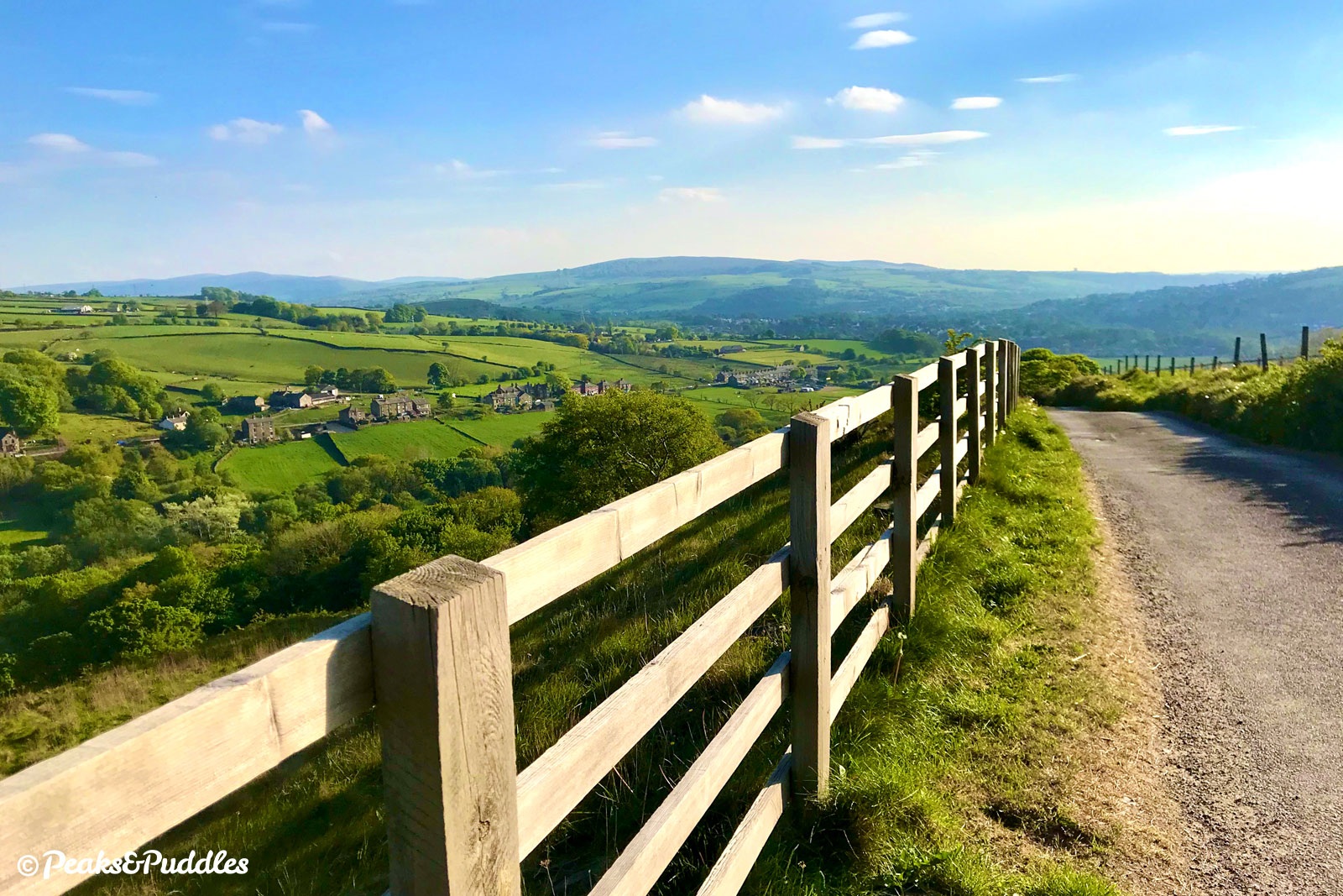
This route begins with the “back route” to Hayfield of Sitch Lane, which feels surely like a spelling mistake as its unforgiving ascent leads to a stunning view over the Sett Valley, bound to leave you gasping and aching.
On its eastern side, Chinley Head acts like a causeway from the wider hilly range known generally as Kinder Scout, allowing the boundaries of the National Park to spill outwards across its top at a spectacular point known as Peep-O-Day. Here a tiny eye-shaped window on the front of the farm house is said to catch the first glint of morning sun over Kinder. Truly one of the cycling highlights of the western Peak, this leads into a fabulously long 2.4 km (1.5 mile) descent below Cracken Edge.

But the key to this route is really Highgate Road, the single-track road which mercifully mirrors the completely un-cycle-friendly A624 climbing out of Hayfield. Well, almost — it frustratingly turns to meet the A-road 400 metres (a quarter of a mile) too soon for the summit, meaning there’s either a slightly bumpy bridleway diversion or a bit of a road sprint to complete the link.
Don’t let this or the high elevation count put you off — in fact, if you just want to try the awesome Peep-O-Day for the first time, it’s possible to skip the initial climb halfway up Lantern Pike (another brilliant local name) by simply following the Sett Valley Trail out to Hayfield. See the ‘Other route options’ for tips on this and an even more strenuous return churn.
Route map
The route stats featured here are automatically generated by Komoot. For the most accurate guide, please refer to the route details above, based on actual rides recorded by Strava.
Where to start
The mapped route begins and ends on Market Street in the centre of New Mills. This allows a bit of a warm-up out through Thornsett before the serious hill climbing really kicks in.
If you’re coming from the Upper Peak Forest Canal cycle route, leave opposite New Mills Marina and join the main Albion Road downhill to the traffic lights. Continue ahead over the bridge then turn left onto Hyde Bank Road. Follow this all the way along, via Dye House Lane, until it meets Spring Bank. Turn right to start part-way through Stage 1. At the end of the ride, instead of Stage 7, you could instead turn left at Marsh Lane to quickly re-join the canal at Furness Vale (steps required).
By train: New Mills Central railway station on the Manchester to Sheffield line is at the other end of Market Street. Climb Station Road then turn right onto Hague Bar Road and immediately left at the mini roundabout into the town. Chinley railway station is very close to the route too, though sees a more immediate hill climb.
By car: There are several car parks signposted in New Mills, all pay-and-display. The biggest is Torr Top Street. After unloading, walk your bike up the short one-way Rock Street opposite to join Market Street.
Things to note
- The key climbs on this route (Sitch Lane, Highgate Road, and the very much optional Over Hill Road) get progressively steeper. Highgate Road is the longest, while Sitch Lane for some reason seems to have the most traffic nipping up and down it. All are narrow when faced with a vehicle, likely even requiring you to stop if drivers don’t bother to give way, but all provide incredibly rewarding views!
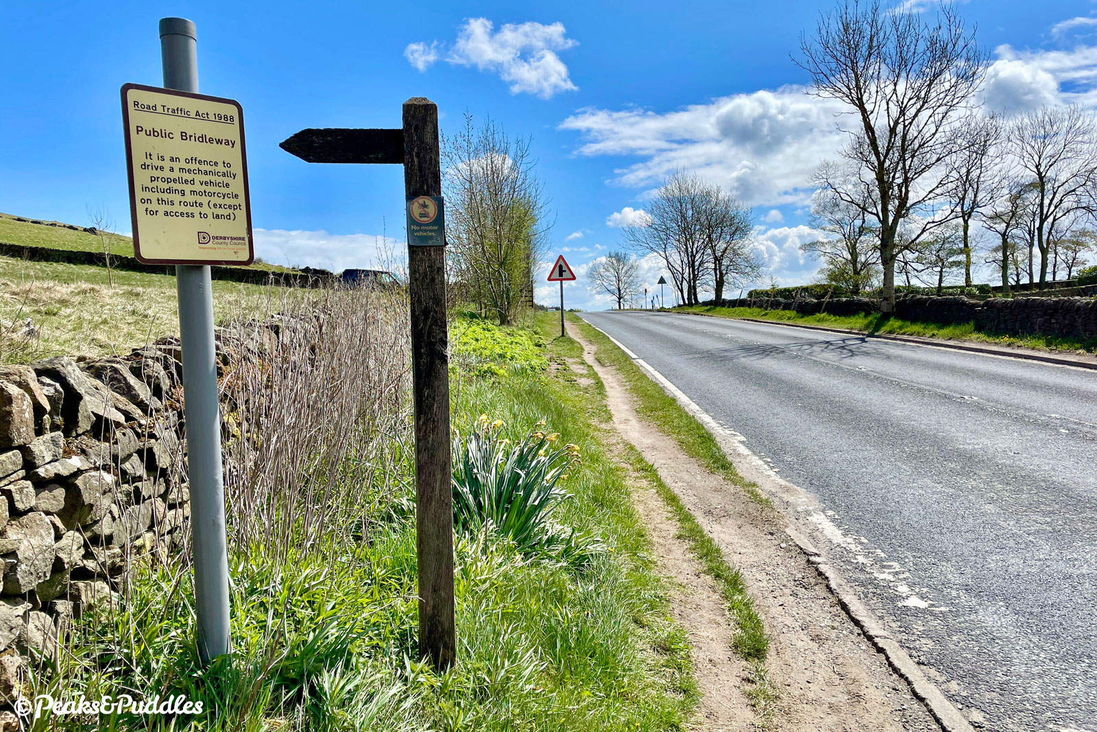
- At the top of Highgate Road, the route has two options: join the fast and rather intimidating A624 Chapel Road for a 400 metre (quarter of a mile) sprint, or — the chosen route for this guide — bounce over a bumpy bridleway which cuts the entire thing out. These are explained in detail in the ‘Route description’ below. If you’re on anything even slightly hardier than a road bike, it’s worth going with the bridleway option first, though there can be a very large puddle half way along in wet weather. Really, it wouldn’t take much for Derbyshire County Council to improve this obvious missing link one way or the other — do write to them if you feel the same.
Found this guide helpful?
Please consider chipping in the price of a coffee to help pay the bills and support my work. Or become a Peaks & Puddles Plus supporter to get access to exclusive routes and pages in return.
Route stage-by-stage
- From the centre of New Mills, head briefly uphill north on Market Street. Passing the Town Hall, the road peaks and becomes Spring Bank with a glorious vista opening up over the Sett Valley towards Kinder Scout ahead and Chinley Churn to the right. It soon drops down past larger gritstone houses then terraced cottages onto Bridge Street close beside the River Sett. Emerging around a couple of bends onto Batemill Road, the old-fashioned garage ahead adds to the wonderful back-of-beyond feeling. Ahead, the road climbs suddenly out of the valley floor into Thornsett, first passing the Printers Arms and then an old school house onto a wooded bank lined with houses.
- Turn left into Sitch Lane, which from a distance looks narrow enough to be a private driveway as it branches immediately upwards. Twisting tightly past the entrance to Highwalls Farm, this leads into a stinging pedal-turner to the summit, with no let-up and little space for passing. When the reward unfolds, it’s worth it: a beautiful panorama over the entire Sett Valley, from the Kinder plateau and even right back to the hills of Lyme Park behind you. A brilliant tumbling descent onto Swallow House Lane awaits, with Lantern Pike above to the left, and then all the way to the edge of Hayfield. The honeypot village is introduced in very unexpected style by suburban housing and the concrete flyover of its late 1970s bypass. Turn right onto Market Street and all is forgiven by the picture-postcard view of St Matthew’s Church framed by the curves of Chinley Churn.
- Follow the road right through the village, over the River Sett bridge and around to the left onto Church Street, where it rises uphill. At the top, turn left then stay right onto Highgate Road. The incredibly steep start between tightly-packed houses thankfully soon eases slightly, but there’s still a full 1.2 km (three quarters of a mile) of climbing ahead. This is placated by the mountainous views which soon open up as you enter the National Park, particularly to Kinderlow End on the left and then again to Chinley Churn nearer the top. Here, the road narrows and steepens a bit just as you wish it wouldn’t, making for a final push of “if it’s clear, go for it”. As the lane levels out, a choice of routes: briefly join the busy and fast A624, turning left for a sprint to the absolute summit, or bounce over a slightly bumpy bridleway to cut it out entirely. Unless you’re on a very tender road bike or dislike a bit of pushing, the bridleway is the recommended option.
- Bridleway below Mount Famine option — Ignore the first (very narrow) signposted bridle path and instead turn left just slightly further ahead, onto a wider track between the heather. The first short climb is perhaps the trickiest for bumpy stone but then, at its crest, the gentle bridleway stretches ahead in a truly awe-inspiring view to the foot of Mount Famine. The rather large lake of a puddle in the middle is (usually!) passable before it climbs again bumpily to a junction with the Pennine Bridleway. Turn right onto a smoother stone track which leads down gracefully to the A624. Here the road can be avoided entirely by turning left onto the firm grass verge, until a dropped kerb where it’s possible to cross directly over.
- A624 Chapel Road option — Following Highgate Road to its conclusion, it turns to join the road we’ve been shadowing the whole way up. The A624 is fast and sometimes busy, but there can be reasonable gaps between cars if you’re patient. Nevertheless, turning out left and continuing to climb can be intimidating, and to make things worse there’s a right turn required right on the brow of the hill with poor forward visibility. A simple cheat to avoid this is to instead pull left onto the well-used verge at the top and wait to cross when it’s absolutely clear.

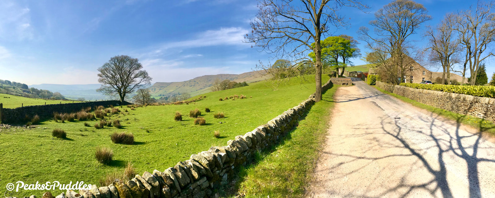
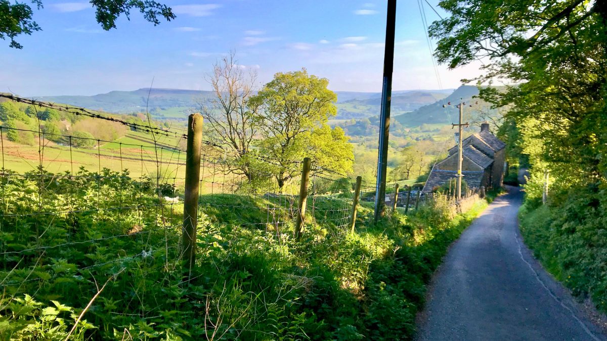
- Turning right into Maynestone Road by either method, be incredibly careful of vehicles approaching fast just below the brow of the hill. Known brilliantly as Peep-O-Day for the way it catches the first of the morning sun, this spot at the crux of the almost mountainous pass has perhaps one of the most dazzling views in the entire High Peak — and one of its most glorious descents for cycling right ahead. Round the corner and the single track lane just drops away, skirting down the side of Chinley Churn like a helter-skelter. Passing isolated houses and a patchwork of fields filled with sheep above Otter Brook, it’s a simply joyous ride, the toil to reach it immediately a distant memory. Below Cracken Edge and a craggy outcrop named “Big Stone” by locals, Eccles Pike comes into view straight ahead, the whipped peaks of the Upper Goyt Valley beyond. Sadly all good things come to an end, and one final gravity-driven hill between houses leads to a sharp bend to finish.
- Emerging into Chinley, turn left beside the war memorial onto Green Lane, crossing the Hope Valley railway line. At the t-junction, continue straight ahead to join the B6062, then follow it to the right between the village shops. Never too busy and mostly downhill in this direction, it’s a rare local B road that feels perfect for cycling. There are views of the Black Brook valley as the road tumbles along, eventually passing underneath the railway line at Brierley Green. Take the next right turn, beside a bus stop, into Dolly Lane.
- Pretty much a local cycling institution, tree-lined Dolly Lane climbs relatively gently up to a summit. From here at Green Head, the gradual tumble back down the hillside begins. At a very steep and narrow drop, keen braking is required down to a tight right-hand bend between more houses. Gentler rises and troughs continue until you descend down under the railway line again at Gowhole. A sharp, blind, right bend is Dolly’s final flourish before you drop again to a sharply-angled t-junction.
- Turn right onto Marsh Lane, taking care with the poor visibility to the left. It’s worth waiting for a good gap in traffic as there’s immediately an unwelcome mini hill ahead — and often a few too many drivers rat-running to avoid the A6. Railway fanatics can at least enjoy the view of New Mills South Junction signal box from the railway bridge at the top, before speed humps kick in for a more sedate amble back in to New Mills.
- At the crossroads with the main A6015, continue carefully straight across onto Church Lane, passing the impressively large Grade II-listed St George’s Church of 1829-30 and two schools. In typical New Mills fashion, the road then hurls itself suddenly down into the river valley. Turn right onto Hyde Bank Road and follow this all the way along, left over the bridge and then left again onto High Street. A difficult final incline often made more challenging by parked cars, it at least deposits you perfectly back in the town centre.
Other route options
- Sett Valley Starter
10.8 miles (17.4 km), 1226 ft (374 m), Moderate
Stage 2’s jaunt up the side of the valley on very narrow and searingly steep lanes can be replaced entirely by following the far more sedate Sett Valley Trail along an old railway line into the centre of Hayfield. Rather than turning left into Sitch Lane, continue straight ahead to Spinnerbottom and Birch Vale to join the trail. Approaching Hayfield, use the shared crossing over the A624, continue past the church and turn right to pick up the main route in Stage 3.
- Extra Churn
10.9 miles (17.5 km), 1752 ft (534 m), Very Challenging
Hills to miles ratio not enough? Stubbins Lane and Over Hill Road provide a ferocious alternative to the B road out of Chinley at Stage 5, neatly linking into Dolly Lane within Stage 6. Simply continue straight ahead past the war memorial, keeping the railway line on your left, to begin the climb part-way up Chinley Churn itself. Shockingly steep and narrow, the lane emerges at a viewpoint; double back downhill to the left to rejoin the main route. The views are sensational but is the ‘Extra Churn’ worth the burn? Maybe, every once in a while.


These options are included as separate GPX files and mapped out with full directions in the Chinley Churner Pocket Guide & GPX download. Also available as part of the Cycle Routes Pocket Guide Collection and Cycle Routes GPX Collection.
Original photography, words and design by Anthony Sheridan unless indicated otherwise. Found this guide helpful? Buy me a coffee to help keep the wheels turning!
The all-important disclaimer: While great care and attention has been put into gathering these routes, ensuring details are accurate and determining their suitability, all information should be used as a guide only and is not a replacement for using your own judgement or research when setting out on new adventures. Peaks & Puddles/the author cannot be held responsible for any issues that may arise from the riders own decision to ride a section of indicated route.
Always ensure your equipment is safe and legal for use and that you are well prepared, carrying everything necessary including access to a good map. Follow the Highway Code and the Countryside Code at all times. Respect the landscape, the wildlife and the people you encounter. And after all that, have fun!


